Friday, April 5, 2019

Death Is Coming For You Next - Graves of New England


A rule my wife and I have is to never pass a graveyard from the 1800s without stopping for a look around. New England is loaded with these gems, and if you walk enough of them you'll realize that many of our ancestors were storytellers. People will tell you how they died, call out old grievances, or maybe even spew one final piece of bitterness. Part of the fun in reading them is to look for themes, and for this collection the theme is; Death will be coming for you next.


1. You Must Soon Come After Me
1840, Gonic NH
Now I am gone, I can't return
You once more for to see;
But it is true, that all of you 
Must soon come after me. 

2. Time's Sithe Will Cut You Down As It Has Me
1801, New Boston NH
From time's sithe there is none that is free,
T'will cut you down as it has me.

3. Death Is A Debt That Must Be Paid To Nature
1830, Newburyport MA

Death is a debt to nature due,
I've paid the debt, and so must you.

4. Prepare For Death, See Here's The Grave
1813, Haverhill MA
My life was eighty two years long,
But quickly ended like a song.
Come young and old you've souls to save,
Prepare for death see here's the grave.


5. Receive Death's Stroke And Turn To Dust
1795, Newburyport MA
No mortal Flesh can e'er withstand
The power of Deaths impartial hand.
But each without resistance must
Receive the Stroke & turn to dust.

6. More And More Of You Must Die
1806, New Boston NH
In this yard lies a numerous throng,
Of great & small of old & young,
Still more & more of you must die,
And in this yard with me must lie.

7. Look And See What Your State Will Be
1811, Beverly, MA
My friends, look here and see
What your state will quickly be

8. Remember Thou Must Soon Depart
1820, Beverly MA
Reader; whoever thou art:
Remember thou must soon depart. 

9. The Next Opening Grave May Yawn For You
- 1815, New Ipswich NH
`
Like crowded forest. trees we stand, 
And some are marked to fall; 
The axe will smite at Gods command, 
And soon will smite us all. 
Learn then ye living! by these mouths be taught, 
Of all these sepulchres instruction true, 
That soon or late Death also is your lot; 
And the next opening grave may yawn for you!


Maybe these messages could be taken from the standpoint of bitterness - yeah, I'm dead, but soon you will be too - but I take them as messages of inspiration. We are all resigned to this same fate, but that is why we must never take our time for granted. I believe that is what these people are telling us. Every day is precious, so be sure to make every day count.


Saturday, March 9, 2019

Abandoned Metropolitan State Hospital


In today's society it's hard to imagine a government agency that goes by the name of the State Board of Insanity, but 100 years ago that is just what our neighboring state to the south had. In 1926 the Massachusetts Board of Insanity commissioned construction of the Metropolitan Hospital in Waltham, to be a state of the art facility housing 1,000 disabled patients. That number swelled to 2,000 at its peak in the 1940s, but the eventual decline in facilities such as this one led to Metropolitan closing its doors in 1992. Today, most of the two dozen buildings that made up this campus have either been razed or re-purposed into housing, but one building at the entrance still stands alone.


My wife and I are two different types of explorers. One of us was eager to pose for all sort of pictures alongside this decrepit building, but then happily called it a day. The other one posed for all the same pictures, but returned a few weeks later to scour the place for a way inside. And the urbex gods were generous upon my return, for within some bushes a small hole provided just enough wiggle room to make entry and, once I was able to stir up the nerve, begin exploring.


No abandoned building is complete without a couple pieces of graffiti that make you stop and take their picture.


Especially fun are those with horror movie references.


Some past explorer tried the same thing I would have, but if there was anything to be found in these drawers, it's long gone.


Massachusetts has several abandoned, campus-style asylums such as the Metropolitan, and many if not all of them contain a bonus - get into their basement and a series of underground tunnels connects the entire complex. Knowing this is the prize of every explorer, workers blocked the entrance to the cellar of this building, and perhaps some frustrated urbexer left this message for anyone who followed.


But you're not going to deter people that easily. Go around the corner and a hole has been punched through, leading to the stairwell below. 


I'm convinced I could have squeezed through - especially with the radiator to boost myself up on - but I'm not as convinced I could have pulled myself back out. In a moment of common sense that caused me to shrug my shoulders, I chose not to attempt to climb through that hole. But I did poke my phone in to snap a couple pictures, luckily without dropping it.


So I decided that if I could not go down, I would go up. Nowadays, a building like this would have a couple staircases plus an elevator, but a hundred years ago they built them with just one stairway. 


I rounded a corner but two things stopped me from going any further. One was this desk that someone had gone through great effort to chuck down the stairway, and although I could have climbed around it, the second and more disturbing thing was a loud thump that suddenly came from above. A thump that I still haven't made up my mind on. Was it a wild animal, a homeless person, or another explorer roaming around up there? I'll never know, because at this point I decided I'd taken enough pictures to call this adventure complete.


Or almost complete, for I stopped to snap one final hallway shot before scampering out the same way I'd scampered in.


There is beauty to be found in something that once was grand, but now has been left to rot. Regardless the type of explorer you are, the Metropolitan Hospital is well worth a visit, even if just to sit on the front steps and pose for a couple of pictures.

Friday, February 22, 2019

B-18 Plane Crash Wreckage - Woodstock, NH


During WWII, German U-Boats along the eastern coast of the United States fired upon and sank 233 American ships through a series of strikes named Operation Drumbeat. These sneak attacks were a tactic the United States was ill prepared for, and which ultimately cost 5,000 men and women their lives. In an effort to thwart them, American planes patrolled the Atlantic coast, but on the 14th of January in 1942, tragedy struck.


Having lost their bearings due to bad weather, pilots of a B-18 Bomber spotted what they thought was the city of Providence through a break in the clouds, and knowing there was an airfield in nearby Massachusetts, set their course north. It wasn't Providence they had seen however, it was Concord NH, and their search for an airfield that did not exist took them into our White Mountains. Their second and final mistake was to dip below the clouds for a peek, where the B-18 began scraping trees until crashing into the side of Mount Waternomee.


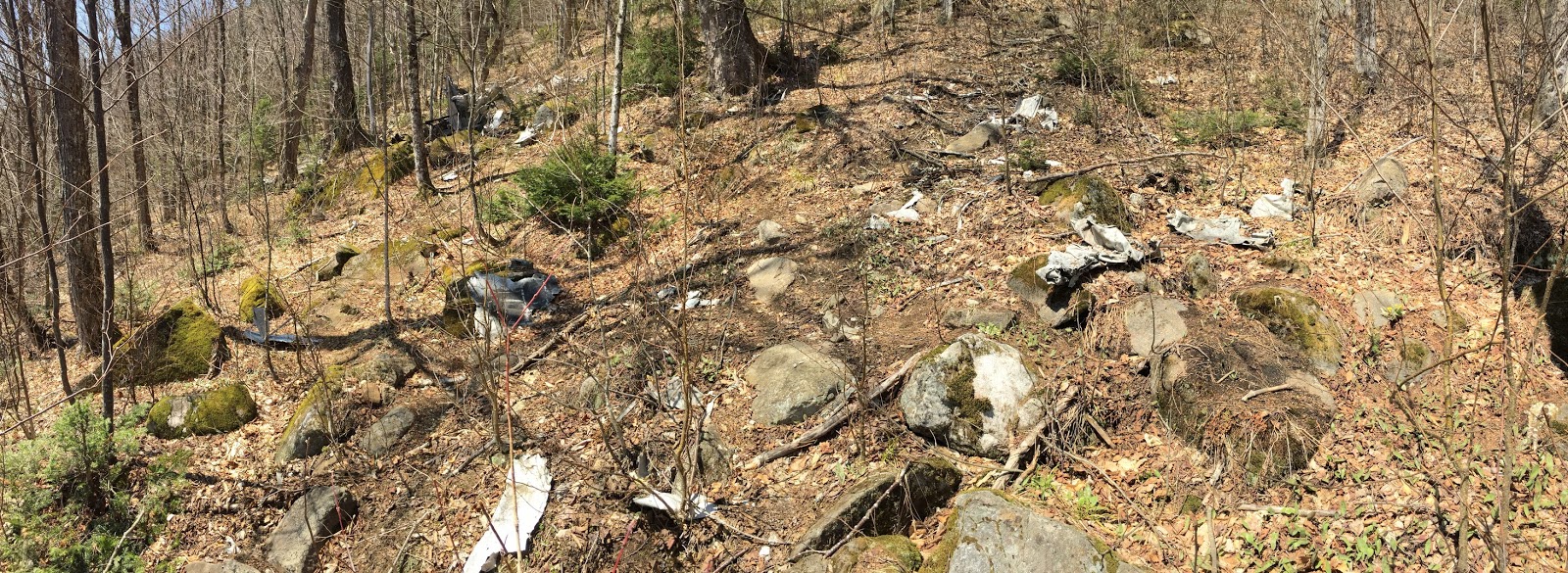
75 years later, wreckage from this tragedy still remains strewn about the mountain, and if you're up for a several mile hike with some fairly steep climbing, you can visit this crash scene for yourself.


It was nearly three years ago that I made my hike up Mt Waternomee, and as a guy who once lost his car keys in the pocket of the pants he was wearing, some of the finer details of that trip have escaped me. I was alone - having skipped out of work for a mental health day - and wandered from one chunk of metal to the next, taking pictures of each while trying not to smile.


When you visit a plane crash site in the mountains of New Hampshire, generally speaking, you're not going to find a plane but instead hundreds of pieces of metal. The remains of this B-18 were no different.


Some of the most impressive to see were the twin 1,000 hp engines this aircraft came equipped with.


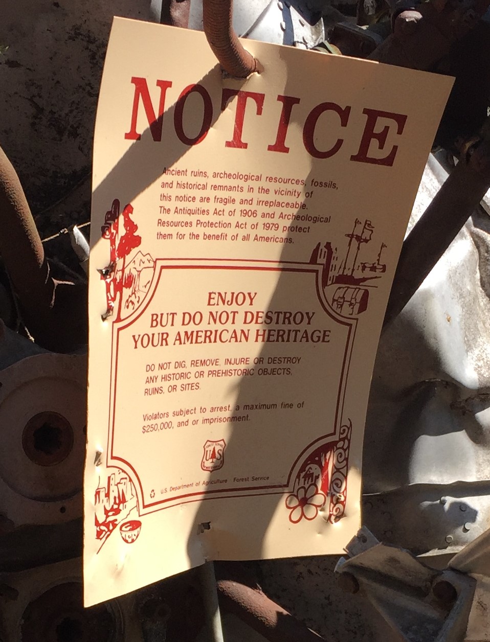
Six men occupied the plane, and although two of them tragically lost their lives, four survived. According to a sign posted at the site by either family or friends of survivor Craig Fletcher, he went on to live a long and happy life back in California before retiring to Washington State.


I found a shard with a crumpled up star on it, and after spending a little time with Google found this picture of a B-18, which seems to have the same logo underneath the wing.


Unlike most adventures where we will spend a couple of hours enjoying our find, it doesn't take long to feel like you're overstaying your welcome in a place like this. One lap around the wreckage and I was ready to leave.


There are times when I am trying to tell a story and I'm lucky in that my posts seem to write themselves. If I'm describing something fun like an abandoned vehicle or a forgotten mineshaft, I can often knock out a rough draft in just one evening. Plane crashes are a whole other story, and particularly this one. Because so much about it has been written already, I didn't want to just rehash what better researchers and writers have already had to say, and instead tried to make it about my own personal trip. But that's where I kept getting stuck. Normally I try keeping my stories lighthearted and with a few laughs sprinkled in, but when you're standing at a spot where people lost their lives horrifically, there just aren't that many yucks to be had.

On my return back down the mountain I came across this narrow stream, and because I'm easily distracted, I followed it.


It led me to a small but picturesque waterfall, and although the pictures I took failed to come close at capturing its beauty, it nevertheless proved to be just the distraction I needed. After enjoying it for a while, I finished my descent feeling a little less heavy. Now I had it straight - I wasn't just returning home from seeing the remains of a terrible plane crash, I was also returning home from experiencing a wonderful day in nature.


Thursday, February 7, 2019

Cave Hunting On Moose Mountain - Middleton NH


Northeast Caver Magazine, which maintains the most comprehensive list of caves within New Hampshire that I am aware of, had at last count over 200 wild caves in their database. 'Wild' means it is not one of our commercial caves, which for New Hampshire rules out just two places - the Polar Caves and Lost River. Everything else on that list is a cave sitting alone in the woods somewhere, waiting to be explored.


Within this treasure trove of a database there is one thing you will not find, and that is any limestone cave created by an underground river. We live in the Granite State, which means unlike those lucky folks down south, instead of long and winding tunnels, our caves are cubby holes and small pockets created by boulders getting tossed around during the last ice age.


A great example of one of these boulder fields is found on the south side of Moose Mountain, a region officially known as the Ellis R. Hatch Jr Wildlife Management Area. There you will find a long ledge littered with thousand of boulders, creating a playground of nooks and crannies to spend an afternoon crawling through.


Our goal this day was to locate and explore the Moose Mountain Cave, the largest of several small caves along this ledge. Between our hike to the mountain and all our searching, my GPS registered just a tick under 3 total miles we traveled that afternoon. And if not for the last ten percent that found us clambering over rocks, this would have been a pleasurable walk with a couple nice sights along the way.


Pleasurable is nice, but it's not something that's going to get me out of bed early on my day off. For that I need adventure. Also, I'm part of a marriage that is one big competition, so this quickly turned into a contest of who could find the official cave first. Bragging rights for the biggest unofficial cave went to my wife Tina, who found a crawlspace that opened into an underground chamber big enough for me to hang out in. Although we referred to it as Tina's Cave, a very old bear trap outside its entrance told us we were not the original finders of this spot.
A fun cave to investigate if you don't mind getting dirty. Or eaten alive.

One of us eventually located Moose Mountain Cave near the top of the ledge, and the fact that I can't remember who it was means it wasn't me. The cave resembles a hallway, and for most people I'm guessing that walking to the end of it is their entire exploration.


But I'm also guessing that good judgement factors into most peoples explorations, and that's where our roads fork. I scoured the cave and found a small hole along the bottom-right wall which led to a second chamber, and looked barely large enough for me to slither into. I made it through the opening and into this second room, left a coin in the back as a present for the next person who dared venture inside, then posed for a couple pictures like a whack-a-mole before coming out.


In addition to being a successful exploration, Moose Mountain was a great example of one of our favorite types of adventures - it was a day spent out in nature, it was time spent doing things with friends, and it was a place that had just enough surprises to send us home that night with a couple of new stories to tell.


Saturday, January 26, 2019

The Carved Stones of Newbury Massachusetts


Visiting the carved stones of Newbury is the type of adventure you go on when, after over and over failing to take serious your doctor's orders, you eventually end up with discharge papers that have the words no hiking written smack across the middle of them.

The Newbury Stones are roadside markers that take us back to the early 1700s, when without the aid of travelling gadgets such as Waze or Google Maps, people relied on rudimentary things such as stone markers to guide them from town to town. Ten stones still exist from the original Newbury collection, which are famous for being some of the most elaborate stone markers in all of New England.


Many of the stones had become lost over the centuries, only to be discovered in recent years either face down on the ground or tucked away on private property. Four of them were crated and shipped to the Smithsonian Museum of American History, one is in a private collection and has been replaced by a replica, but remarkably, five are back standing in the same spots they were placed nearly three hundred years ago, roadside in Newbury where anyone can drive right up and see them.


Located on a small patch of land within the intersection of Middle Road and Elm Street, is the 33 marker.


Look closely at the stone and you'll see a variety of things. On the left is the number 5 above the letter N, indicating that the center of Newbury was five miles in that direction. The right side contained the number 33 and letter B, which meant that Boston was 33 miles thataway. And below all this is the date the stone was carved, 1708.


Exactly one mile north is the only replica of the collection, the 34 marker. This was recreated from a partial piece that is now in the hands of a private collector.  Arrows point you either toward Newbury or Boston, and it also contains the date of the original stone, 1709.


By the 35 marker, travelers were close enough to Newbury it didn't seem necessary to mention it, so this stone came with only a 35 and a B, letting travelers know they had now progressed 35 miles from Boston.


In addition to being informative, each of the stones came with its own unique designs, which on this one consisted of two circles containing pie slices in each corner as well as a wavy pattern that runs along the bottom. With these clues, historians were able to piece together the identities of the various stonecarvers by matching them against similar designs carved into gravestones of nearby cemeteries.


As you arrive at the 36 stone you might just think you've run yourself in a circle, because at a glance this one appears to be the number 30. But don't be fooled, even though it looks like a cartoon bomb with a fuse sticking off it, this is a number 6. And although there's no date on the 36 stone, the triangle design did get fancier with some added loops and lines below.


The remaining mile marker is the 37 stone, which is also the least obvious to spot from the road.


Although partially sunken into the earth, the B and the 37 - plus a pinwheel on each corner - are still visible. The other side of the stone contains a mile marker for the nearby town of Ipswich, but because I short-cut my research and didn't know this at the time, I can only show you a picture of its front.


There is one more stone in the Newbury collection, and although it's not a mile marker this is the most elaborate of them all. It is called the Father Stone, featuring a two-dimensional figure dressed in 17th century garb, and was created as an entrance marker to the mansion of the family who commissioned many of the Newbury Stones, the Dummer family. That last sentence does not contain a typo. The Dummer family were prominent members of early New England society, and among their many accomplishments, their bequeathed estate led to the foundation of the Governor Dummer Academy, referred to now as just the Governor's Academy.


There is pleasure to be had in an afternoon ride, even more so when you can turn that ride into an afternoon scavenger hunt. There is also pleasure to be had in experiencing history, especially when it's history that took place close to your home. And there is pleasure to be had in the faces of passersby, as they watch from their car while you pose with a rock on the side of the road.

* To find the location of each of these stones, go to our Adventure Map and zoom in on the town of Newbury, in eastern Massachusetts. 


See also:
- The Mother Stone, now in the Smithsonian Museum of American History.
- To learn more about the history of the Newbury Stones, visit www.stonestructures.org