In the north part of the town, about 100 rods from the principal road leading to Deerfield, near the summit of a hill about 100 feet high, is a natural excavation in a ledge, called the Oven, from the appearance of its mouth. It is a regular arch about five feet high and of the same width, extending into the hill about fifteen feet, and terminating in a number of fissures.
This 170 year old description of a cave hidden within a cliffside in Raymond, NH was more recently popularized in Clay Perry's 1946 book, Underground Treasures of New England". But when I first began my search for it, not a single clue to its location existed online. In fact, the only place that offered any information on it whatsoever was the letters section of the 1998 Northeastern Caver, Vol 29 No 3, in which the author had been told the cave was thought to be lost to construction. This was only a rumor, but with nothing else to go on I back-burner any further thinking about it. Then I was sent a picture by a talented fellow explorer named Chris, showing me that the cave actually
did exist, and I was challenged to see if I could find it.
My first attempt started by identifying the principal road in the Gazatteer's description. From Raymond to Deerfield the obvious choice was Route 107, and I hoped this had been the case in 1849 as well. Next, Google then told that 100 rods equaled a third of a mile, so I took a drive looking for any cliffs within sight of the road, and start by exploring those. I spent an enjoyable afternoon in the woods that day, but the only interesting thing I came across was this abandoned motorcycle frame.
After looking again at Chris' picture, it seemed as if the cave had been formed by a waters flow. The Lamprey River runs parallel to Route 107, so for my next attempt I focused on undeveloped areas along the water's edge. A couple of weekend searches turned up several cool finds, but nothing that involved me crawling underground.
I wouldn't call this log cabin elaborate, but somebody put a good deal of effort into building it, even furnishing the inside with some rudimentary decorations.
My wife had joined me on this search, and the look on her face at this moment is one of both humor and disbelief. She had leaned over the well to have a peek inside, when her sunglasses dropped off her head and fell in. The good news was that it wasn't a real well - the glasses were just sitting there on the ground - but the bad news was that "man-eating spiders" prevented her from reaching inside to get them. Always the hero, I brushed aside a couple of daddy long-legs and retrieved the glasses for her.

By now we'd exhausted this section of town, so the next search was focused around a rocky ledge I'd pinpointed using Google Earth - north of 27 and west of 107. I parked where a trail followed power lines toward this ledge, then spent yet another afternoon scouring the woods. Again I came up empty, but this time I was so convinced I had the right area that I returned a week later with friends to do it again. We still didn't find it, but my camera got a good workout with all the other treasures we did come across.
Deeper in we found a few structures that I assume are used by hunters.
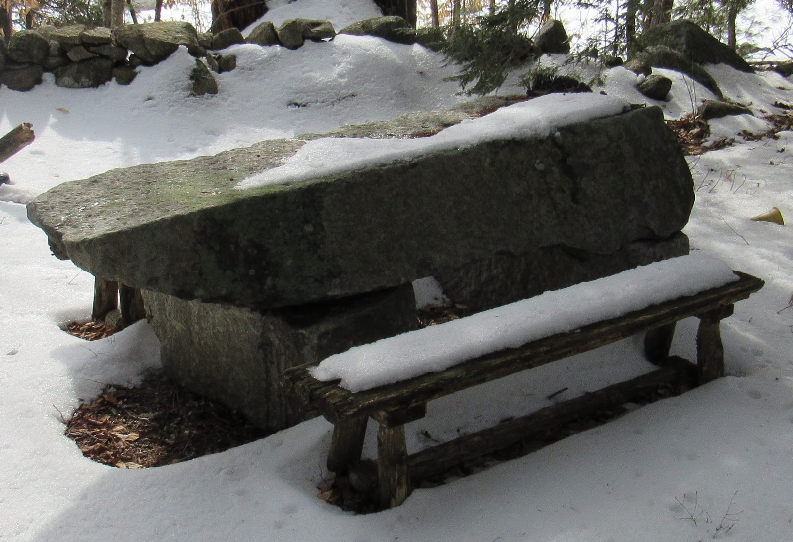
As we wandered the remains of a frisbee golf course, there was a very impressive stone picnic table.
But by the end of the day I was forced to admit that, although these woods held an abundance of cool things, this wasn't the right location for the cave, either. Back to Google Earth I went, and looking to the east this time I found a rocky location that was exactly a third of a mile from 107. The following weekend we were back at it, my sixth attempt to locate the Raymond Oven.
This ledge was separated from the road by a large marsh, leaving no direct route to reach it. We parked in a neighborhood on the opposite side, and after a 1.5 mile hike we found our second homemade cabin in the woods of Raymond.
When we reached the ledge our group of 5 split up, and the race was on. For all my frustrations and chasing dead ends in the weeks leading up to this point, my good fortune changed and I was the first to stumble upon the cave.
As with most legends, there was some exaggeration when it came to the Raymond Oven. As you can see by how I'm sitting in the opening, it is probably half that height of the five feet described in the 1849 Gazatteer.
But it did go in a ways, and we each took turns crawling inside and having a look.
It was great day out in nature spending time with friends, and pretty cool to chase down something as historical and yet little-known as this. Our friends from WeRmudfun documented the adventure on video, so click on
this link and join us as we find and explore the Raymond Oven, one of the great treasures of New Hampshire, hidden within its woods.