Saturday, October 19, 2019

Memorials of N.H. - Her Blood Still Shows On The Rock


Special thanks to the Historical Society of Lee, and particularly Kevin Shenefiel, for research and assistance in piecing together this interesting slice of history.


A few years back our family was returning from a camping trip one Sunday afternoon. Camping with two young kids is a wonderful way to spend the weekend, but it is not a relaxing one. After two full days of swimming, fishing, and late night fires, I couldn't decide what I needed more desperately, the coffee maker or the shower.

That's when we drove past this curious turnstile gate at the entrance to an old graveyard. It was the kind of thing that would normally have us turning the car around for a better look, had it been just my wife and I on an afternoon drive. So we did what any reasonable people would do in our situation - we dropped the kids off at home, quickly unpacked, then drove back to the cemetery to explore it.


This was not too large of a graveyard, and we had wandered through most of it without finding anything unusual, when toward the southern side we saw a curious and out of place boulder. It was the kind of rock someone might plop in their front yard as decoration, but with a short path leading up to it. At the head of the path was a Town of Lee historical marker.


Several gravestones lined the path to the boulder, and there we found the grave of Elizabeth Burnham, explaining the presence of the stone and suddenly making our whole trip worthwhile.

ELIZABETH BURNHAM
Aet 23
Fatally shot by Indians in Durham. May 22-24 1721
fell upon this boulder which
still shows the stains of her blood
Hers was the first burial here.
These stones were placed at
her grave by
S. Millett Thompson &
John J. Bunkey 1907


My wife is a fan of everything morbid, and at the mention of blood still showing on the rock she gave it the kind of inspection that would've had NCIS taking notes. But of course this was written almost 200 years ago, and whatever blood once stained it has long since washed away.


This was a great find, but it left us with more questions than answers. I back-burnered the info for a few years, but after coming across it recently I wrote to the Historical Society of Lee and asked what they could tell me about Elizabeth Burnham and the rock.

I received a very nice reply thanking me for my interest, saying there was a lot of conflicting information about the story, and that one of their researchers would put together some info and send it my way. Two weeks later I received three pages of notes and references, and with those plus a few more tidbits I found we have a couple variations of the following story.

Born in a time of ongoing skirmishes between Native Americans and early settlers, in 1724 Elizabeth Burnham was returning from church with fiance George Chesley. The two were attacked by Native Americans, with Chesley dying immediately and Burnham dying four days later. This information comes to us from church records of Reverend Hugh Adams, who when lamenting deaths within the church's congregation over the prior week, noted that:

In the evening by the indians was killed by a shott (sp) in his head poor George Chesley and Elizabeth Burnum was wounded."


And in a subsequent entry regarding baptisms for the congregation, Rev. Adams followed up with:

 "May 27, 1724, Elizabeth Burnum, who was wounded by the indians the 24th, the day George Chesley was killed, the evening before she died I baptized at her penitent request.


This story is reiterated in subsequent writing, including The History of New Hampshire by Jeremy Belknap, who says of Native Americans on May 24, 1724:

On Sabbath day they ambushed the road at Oyster River, and killed George Chesley, and mortally wounded Elizabeth Burnham, as they were returning together from public worship.


And in the Indian Wars of New England, Volume 3, by Herbert Milton Sylvester, the following is said:

May 24, 1724, Sunday, the savages ambushed the Oyster River trail. George Chesley and Elizabeth Burnham were making their way home from church.  The hidden savages killed the man and mortally wounded the woman.


Even though the above corroborates Rev. Adams records, already there are questions about the story. Was her last name Burnham, or Burnum? Did the attack take place on a road, or a trail? Also, where does the bloody rock come into play with all this?

A more descriptive account that includes the origin of the rock comes from A History and Description of New England, General and Local, by Austin Jacobs Coolidge, John Brainard Mansfield. In speaking of the Indian wars, they say:

Among the traditions is one of a Miss Randall, who was betrothed to Thomas Chesley of Oyster River, and was about to be married. She was returning from Oyster River falls one day with a party of friends, when they were surprised by Indians. She tried to escape, and ran towards a barn standing near, for refuge; but was shot just as she was going into it, and fell across a stone, where she soon bled to death. The stone is preserved; and it is said, that, when a heavy rain falls upon it, her blood-stains can be clearly seen.


Now we know about the rock, but here's where we run into all sorts of other problems. George Chesley is now Thomas Chesley, Elizabeth Burnham is referred to as a Miss Randall and is said to have died on the boulder instead of four days later, and rather than returning from church, the pair were leaving a gathering of friends by the falls of Oyster River.

Another telling in Historical Memoranda Concerning Persons and Places in Old Dover N.H. John Scales, gives a similar account of Thomas Chesley and Miss Randall, with the added details of how the stone began its journey to where it stands today:

(Miss Randall) tried to escape, and ran towards a barn that stood near, with the hope of hiding herself, but was shot just as she was going into it, and fell across the stone at the door, where she soon bled to death. That stone has since been taken up to Ephraim Bunker's farm, and it is said that when there is a heavy dew the blood stains can still be seen upon it.


Confusion is added by saying that Chesley survived the attack, gave chase, killed 11 Indians before dying himself, and that all this took place in the year 1708:

Mr. Chesley was greatly grieved at her death, and declared he would spend his life in fighting the savages: he took his gun and started out: he soon came upon a party of twelve Indians and the fight began: when it was ended he had killed eleven of them, single handed, the other escaped. It is thought Chesley was afterwards killed by the Indians near Oyster River. He was dead in 1708, leaving a son Samuel who was born in 1691; Samuel chose his uncle George for his guardian, 7 June 1708.


As an aside and as another potential source of confusion, we also have another George Chesley being ambushed and killed in 1710. In The Ancestry of J.G. Williams & Ursula Miller by Jim Schneider & Holly Rubin, we are first told the original story of George Chesley in 1724, but cautioned us not to confuse him with an earlier victim of the same name:

George Chesley, who was killed by Indians on his way to mill, 8 June 1710, leaving widow, Deliverance.


When you boil all this information down, we end up with two distinct versions of the same story. One says that George Chesley and Elizabeth Burnham were attacked May 24th in 1724, with Chesley dying on the spot and Burnham succumbing four days later. The other has Thomas Chesley and Miss Randall being attacked in 1708, with Miss Randall dying across the rock and Chesley being killed soon after giving chase.

Which story is to be believed, or is the truth maybe even a blend of the two? I'm a big fan of history, but that doesn't make me an historian, so rather than make my own uneducated guess I'll just lay out the facts I have read, then invite you to visit the stone for yourself and draw your own conclusion.


Elizabeth Burnham's grave and the memorial stone are located in the Old Parish Cemetery, at the intersection of Garrity and Mast Roads, in Lee New Hampshire.


Saturday, October 5, 2019

Abandoned Lead Mine, Woodstock NH


In 1905, Fred Hunton purchased land on Mt Cilley in Woodstock New Hampshire, and operating as the Hunton Mining Company began drilling into the side of the mountain. He was in search of lead, but as with many mid-sized mines in our state during this period, more wealth went into the ground than ever came out of it. After five unsuccessful years Hunton's bank foreclosed on the property, and no further mining has taken place at the site. A hundred years later, there are not only structural remnants such as a foundation and brick platform to explore, but the prize of every one of our mine hunts, a tunnel.

I located this mine in the fall of 2017. My search led me through a mile-long zigzag as I ruled out one suspect location after another, before I finally - and inadvertently - stumbled upon it via the backdoor. It looked a lot trickier from above, but this shaft was at a 45-degree angle and had plenty of rocks to climb down on.

Nearly all of the mine is at walking height, consisting of a main tunnel and two side ones, dead-ending in either direction. One of these offshoots was too flooded to enter, and the other terminated after a short distance in what may have been a collapse or a backfill.


The tunnel cut through the length of the hill where I exited from the main entrance. Although this was a good day of exploring, unless I leave a place with no stone unturned and no tunnel unexplored, I'm not completely satisfied. I knew someday I'd be back, but for now I fired off a selfie to my wife to show her that not only was I successful, but still alive, and that I was on my way home.


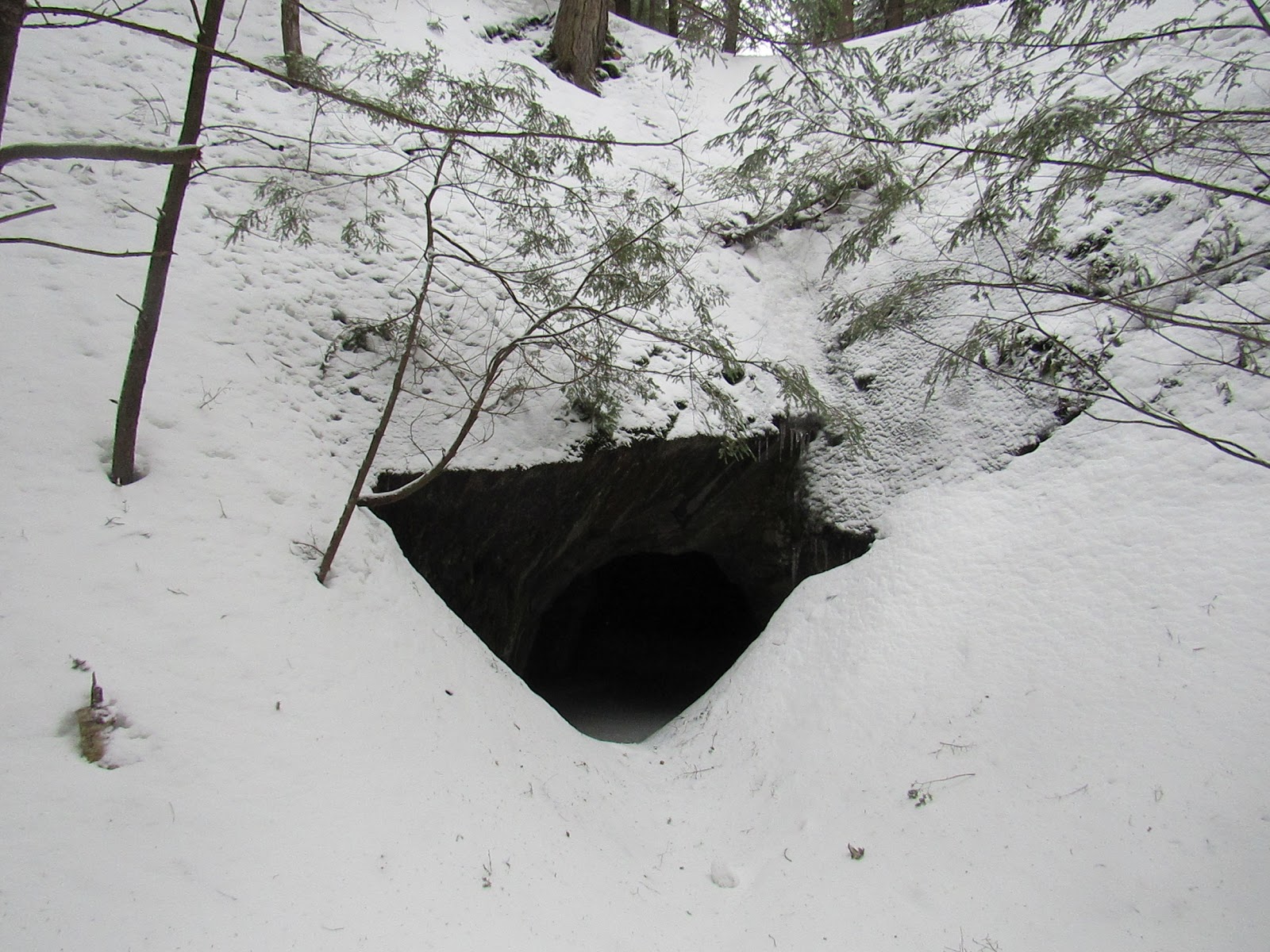
I returned to the site in the winter of 2019, battling several feet of snow-drifts before reaching the half buried - and completely undisturbed - entrance. I hadn't expected any human prints leading into the mine, but it was nice to not see any large animal tracks, either. Over the drift I climbed and entered on my hands and knees.


Although fun to explore at any time of year, mineshafts in the winter - particularly those with ice - are usually a thing of beauty.


On this trip I took my time. Including the main tunnel and side branches I measured 150’ of mineshaft, and considering I was only working with a 25-foot tape measure, that made for a bit of back and forth shuffling along the ice. But I was able to cover the entire mine, including the side tunnel that had been previously off limits due to flooding. As I often do, I left a couple presents in the wall at the end, and I'm hoping to find them gone if I'm ever underground here again.


Now I was able to call my exploration of the Woodstock Lead Mine complete. My database is up to 45 entries and counting, but with rumors of New England's underground mines numbering into the triple digits, having checked another one off the list puts me in no danger of running out of places to explore anytime soon.


Additional Reading:
http://www.logginginlincoln.com/uploads/UPHS_Summer_2008.pdf

Sawyer, Ida T. - Woodstock History, Barbara Avery, transcriber, 2013

Saturday, September 21, 2019

Cherney Maribel Caves


It was my second week of travel to Wisconsin this past July and I was facing three very busy days of business. Having such a heavy workload but still wanting to sneak in some fun, I scheduled myself top-heavy with two twelve hour days to start, leaving a normal eight hour shift and a free evening of exploring for my final day.

Having done a random drive for my previous WI exploration a few weeks back, this time I decided to specifically seek something out, and I started by searching my favorite things to explore - anything underground. I scrolled through the meager cave listings Wisconsin has to offer, and a particular review under Cherney Maribel Caves decided for me that this was the place to visit. I'm guessing this person went there expecting a nice touristy cave with a gift shop, because their review was a warning to others - that this was not a business, but an actually cave in the wild.


Maribel Caves is plural. In total there are seven caves located within this cliff in eastern Wisconsin, originally documented in the late 1800s and soon after purchased by Charles Steinbrecher, who in 1900 founded Maribel Caves. Remains of Steinbrecher's hotel still stand on an adjacent field to the cliff, and although the field is private property, the ruins can still be admired from afar.


From my hotel, and including running back from the parking garage to the sixth floor because I forgot my phone cord, it took me an hour and a half to arrive at the Cherney Maribel Caves Park, putting it just after 7:00pm. Pretending not to see a sign declaring that the park closed every night at dusk, I took off into the woods.


I was double-timing it down the trail and within five minutes came to a stone wall and structure that took me completely by surprise. At this point I knew nothing about the separate hotel ruins, and since this building was marked no trespassing, I continued on my way.


In 1963 the current owner of this land, Adolph Cherney, sold it to Manitowoc County, which used it to create their very first county park. And because this is a public park, helpful little signs have been posted to point you toward the good stuff.


I followed the sign for New Hope Cave, and soon found myself wondering if I should have spent my free night at the hotel bar. A steel door stood between me and the New Hope Cave, and a big steel lock prevented that big steel door from opening.


What I did not know at the time is that, although seven caves can be found along this stretch of cliff, at 200' in length the New Hope Cave is the largest of the bunch, and mostly closed to the public. I say mostly because tours are given by volunteers of the Wisconsin Speleological Society once every month. Only on a Sunday though - show up on a Wednesday night when you're pushing dusk, and this cave is strictly off limits.

The good news was that most of the other caves I found were wide open to exploration. The bad news was that I was exploring in a work shirt, my favorite pair of sneakers that I hoped to keep clean, and with just my cell phone flashlight. But if I pride myself on anything it is never backing down from a good story, and so that is how I entered my next find, the appropriately named Pancake Cave.


Although not much bigger than our New Hampshire cubby-hole boulder caves, Maribel Caves differ in that they were formed in the more traditional sense - by water running steadily through soft limestone for eons of years. I read once that due to a whole bunch of physics, it is impossible for a river to form in a straight line. Twists and turns are an inevitable result of Nature's forces. I think the same holds true for caves. Cooper Cave, the next one down the path, was a fine example of this, passing through a winding hallway before terminating in a cozy little room.


I've gotten pretty good at playing with perspective in my pictures, and although this next tunnel may look like something I took a nice easy stroll through, I traversed the Cave of Treasures entirely on my hands and knees. I soon reached a room big enough to squat in, and although the tunnel continued out the far side of the room, this was the point I called it a night, crab walking my way back out before using the last of my bottled water to wash off my hands and knees.


I ended up exploring three of the seven caves before darkness chased me out of the woods that night, which means I still have over 50% of the job to complete. I made it back to the hotel quite late, and was tired enough the next morning that I unwittingly strolled through the airport metal detectors with a beer cap in my pocket. Not my finest moment, but it gave me a chance to get to know the TSA screener on an intimate basis. When telling the story of this trip to the mid-west, however, I'll leave those details for the blooper reel, and instead focus on my adventure of an after-hours chase through unknown woods in search of wild caves.
Creepy


https://www.maribelcaves.com/


Saturday, August 10, 2019

Traveling Curiosities


I spent two of the past three weeks travelling to Wisconsin on business. The downside of this was that I had to leave two kids and a wife who curiously still enjoy my company, but the upside was that there is no better opportunity to go out exploring in an area I am unfamiliar with.

One thing to look out for when you're wandering a new town are old cemeteries, and with this in mind my first stop was the Riverside Cemetery in the city of Oshkosh. This is a city best known for Oshkosh Overalls, a company my wife single-handedly kept in business while each of our kids were toddlers. I pulled into the cemetery with no idea of what I would find.


The Visitor's Chair
Nathaniel "Than" Young passed away at 39 years of age, and although he battled health issues most of his life, his outlook was always positive, he continually sought new pleasures and experiences, and among his final wishes was that everyone "be kind to one another." Without actually knowing him, I'd say we could always use a few more Thans in our world.

His obituary, which I came across after googling the names on this grave, welcomes anyone who finds themselves near Riverside Cemetery to "come and sit in the big chair ... hang out with Than and his brother, Andy. They always liked company." I wouldn't have touched the grave on my own, but now that I've found this invitation, the next time I'm in the area I'll be sure to have a seat and offer up Than some company.


Mystery Stone Dog
If you're like me you will look at this next picture and see three stuffed animals - two bears and a dog. And like me you would be 67% correct. The bears are both stuffed, but the dog they are snuggling with has been carved out of stone.


This was a cool little find on its own, but it became a lot more fun after I researched it and found the below article from the Oshkosh Northwestern Newspaper, dated 1963. It describes how the dog has no inscription on it, and although it sits near a hundred year old monument for the Spaulding Family - and presumably belongs to them - no mention of the dog was ever made. A head scratcher, the mystery was deepened by the fact that flowers were regularly placed alongside the dog by a young girl. That young girl would be of retirement age by now, but someone is still regularly coming by, and they are still regularly leaving gifts for this little fellow.
September 13, 1963 - Oshkosh Northwestern


A Derelict Truck
Leaving the cemetery I spotted this old truck in a field next to a private dirt road. I drove down the road, pretended to be lost, snapped this picture, then pretended to suddenly remember where I was going again and scrammed it off the property.


The Recording Angel
Listed in the National Register of Historic Places is the Recording Angel of Waupun, Wisconsin. Commissioned by local philanthropist Clarence Shaler for his wife Blanche, this angel is the main attraction of the Forest Mound Cemetery. To capture its size, I adjusted my parking job to make sure my rental car was within the picture's frame.


A Yard Full of Curiosities
Driving along Route 45 in Oshkosh I spotted what could almost be described as a museum-sized collection of lawn ornaments strewn about an adjacent property, so I took the next exit and wound my way back. I'm still not sure what it is I stumbled upon, because when I say lawn ornaments I'm not talking about the cute little gnomes people like to place in their gardens. I'm talking larger than life replicas of all types of animals, plus a host of other cool things.

Some of the statues were based on real animals, but others were straight out of the fantasy books.

There were also staged scenes such as this rhino about to flip over a safari vehicle, with two mannequins along for the ride. I wondered if this might be a recreation of some movie scene, but Google told me it didn't think so.

You can't put this many great things on your front lawn without expecting people to stop and check them out, so I parked in the driveway and wandered the property - tentatively at first - admiring the collection. I half-hoped someone would spot me and come out to chat and give me the story behind all this, but I also half-hoped nobody would spot me, for fear they might come out swinging. In the end, nobody noticed my presence and I was left to explore in peace.

I didn't snap pictures of everything, but I did capture enough to show to broad variety - and the craziness - of this collection. And when I say craziness, I'm saying it 100% as a compliment.

So many situations in life can be taken in different ways. A business trip consisting of long days at the office, combined with beer and catching up on emails back at the hotel, could very well have been the story of this week. And there are times when I have happily chosen that path. But those aren't the memories that stand the test of time. Exploring a new city and chasing down all sorts of curiosities however? That's a memory I'll cherish for as long as I'm out there attacking every new opportunity life throws my way.

Saturday, July 27, 2019

United Mica Mine


Among all the great places hidden within the woods New Hampshire, my very favorite things to explore are abandoned mine shafts. Hundreds of sites were mined within our state over the past two hundred years, and of those hundreds I estimate there are 40 to 50 that have underground workings. Underground could be as simple as the single cavern we found at the Barney Mine, or the more than thousand feet of tunnel that make up the Ruggles Mine playground. With approximately 240 feet of underground tunnel, this next mine falls somewhere in-between the two of those.


Details get a little fuzzy when you're researching these old places, but United was a mica mine whose glory years took place prior to the 1920's, when it was run by the United Mica Company out of Grafton NH. It then went unworked for a period of time before local man AW Bennett purchased the site in 1936 and made a quick 2-year go of it. After that, the final attempt to turn a profit came from the United Mining Company of Andover NH, who called it a wrap in 1944 after determining there was only one small pinch of mica vein left to chase. A few of the tunnels were partially backfilled, then the mine was abandoned and left in the condition it can be found in today.


Our first exploration was during the tail end of the winter of 2018. Four of us piled into the Jeep and drove as far up the old mountain road as it would take us, then when we could go no further strapped on our boots and made the final half-mile hike to the mine.
photo by John Egolf

A 140 foot long open cut, or trench, was the starting point for our exploration, running parallel to and roughly 100 feet downhill from the road. Within this trench are several openings, which although look like entrances to separate tunnels, we soon learned all led to the same underground network. Some of the openings required a mixture of climbing and crawling to enter, so we stuck to using them for photo ops before heading to the main shaft.
photo by John Egolf

There is no easy way to enter the mine, especially if you're exploring in the winter as we were. Our research told us its entrance was at the bottom of a 45 degree slope, and on this day the entire thing was covered in ice. The level-headed amongst us decided to admire it from a distance, while the more foolish members of our group chose to risk the climb down. Here I am, alone, at the bottom of the slope.
photo by John Egolf

But sometimes the foolish are rewarded for their efforts, for the far superior view of this slope was from the bottom looking up.
United Mica Mine

I ventured over some rubble and under an archway, where the tunnel led me through a pair of rooms before ending at a point I suspected was somewhere underneath the road. And here's what I love about places such as this. No matter how treacherous it was to enter, or how forgotten you may think it is, somebody out there knows about it already. I was 200 feet underground in a hundred year old mine, yet here was a ratty chair parked in front of a fire pit. Somebody out there considers this a favorite spot to sit. Or, judging by the condition of the chair, they used to.


The other cool thing I found was when my flashlight happened across something shiny, which when I turned back was this beautiful chunk of quartz. I'd have liked nothing better than to bring it home and plop it in my front yard, but there's a reason I never entered any strongman competitions.


I left a coin in the cupholder of my fellow explorer's chair, then made my way back out of the mine. This several square mile area is a hotbed of mining, and I made a subsequent visit later that year while exploring a nearby mine. The chair was no longer there but the fire pit was, and in fact looked to have been recently used. I scattered a few more presents on the rocks where they would be nearly impossible to miss, and I'm anxious to see if any remain on our next expedition. There is at least one more tunnel mine in this vicinity that I've yet to locate, so I expect our return into United Mine to be sooner rather than later.
photo by John Egolf

Saturday, July 13, 2019

Douglas Mountain Stone Tower, Sebago Maine


Not for one, but for all

- Dr. William Blackman


There are those who would get their hands on something beautiful and hide it away for themselves, never to share it with anyone. There are also those who would get their hands on the same beautiful thing, but instead will want the whole world to experience it. This adventure starts with one of my favorite types of people, someone who falls squarely into the latter group of men and women.


A century ago, Dr. William Blackman purchased Douglas Mountain in Sebago Maine, and in 1925 constructed a stone tower at its summit. He didn't build this tower just for himself, at least not entirely, but instead built it for anybody willing to make the relatively easy hike to the mountain's peak. To emphasize this point, onto a boulder at the summit he had carved the Latin phrase, NON SIBI SED OMNIBUS, which roughly translates to mean, not for one but for all.


If you're interested in seeing the tower, it can be reached in just over a half-mile beeline from a parking spot off Spring Ledge Road. Our hikes are more like our Sunday drives, however, so rather than this direct route we chose the longer and more scenic one, and for this we have scout Seth Newcomb to thank. His eagle project gave us the Eagle Scout Trail, a two-mile loop bringing you out along the mountain's scenic ledge, before tracking you back to the summit.


We're lucky in that more often than not on our hikes we find at least one unusual thing in the woods, something we could never have predicated being there. Today was another one of those days, as we came across not just one, but two, of these round structures.


Hiking to our much taller firetowers, often you will see the tower peeking out over the treetops before you actually arrive at it. That is not the case with the Douglas Tower. At just 16 feet in height, it wasn't visible until we exited the woods and turned the corner, when suddenly there it was.


Climb the tower and you will find both great views of nearby mountains, plus a map showing what each of the mountains you're looking at are. If you're like our friends at WeRmudfun, you can have a whole lot of fun pointing out the dozens of peaks you have climbed already. And if you're like myself with not nearly as impressive a resume, you can have just as much fun pointing out all of the peaks you've heard of and cannot wait to climb someday.


And with that many mountains still out there to climb, I never have the right to complain about being bored while I'm living in New England - unless maybe we're in the middle of a thunderstorm or a nor'easter. But if those words ever come out of my mouth while the sun is shining, someone needs to kick me off the couch, tell me to pick a random spot out on the map, and then go outside to conquer it.