Saturday, October 21, 2017

Ruins of Camp Wunnegan


Do a little exploring in the woods of Shrewsbury Massachusetts and you might come across the ruins of a former girl scout camp named Camp Wunnegan. History is sparse as for what I've been able to find online - when you're chasing leads from page 9 of Google's search results you know you're desperate - but the info I've scratched together confirms a couple things. First is that the camp was in operation at least until the year 1966, which is the date of an article in the Fitchburg Sentinel newspaper describing an outing at the camp for disadvantaged scouts. Second is that by 1978 the camp was abandoned, at which point the town purchased 30 acres it resided on and added it to an abutting 15 acres it already owned. What happened in-between those years to lead it to such a state of neglect, I've yet to learn.

We made the trip to Camp Wunnegan in the summer of 2017, and right from the start the head-scratching began. Between two residential houses we found the trailhead and a kiosk, an entry path that made it feel like you were walking into the neighbor's backyard, and no parking. It's tough to feel welcomed when you're forced to park around the corner in front of some stranger's house but that's exactly what the map told us to do, and never ones to shy away from doing something uncomfortable, there we parked and in we went.


To come clean, this was a stop-off visit to see the ruins and we didn't have any intention of walking the entire trail system that day, so when we finally spotted our goal that's directly where we headed.


Whatever activities are taking place nowadays in this former girl scout's cabin, you can bet it isn't a cookie sale. Aspiring artists and fire enthusiasts seems to be the main inhabitants lately. Fortunately we were there around noontime of a Wednesday and had free roam of the place, so we were able to work in a few posed pictures. Here is Tina pretending to rub circulation back into her hands after coming inside on that frigid August day.


And here I am resting with a sip of water, something which earned me a roll of the eyes from my wife and a pair of rust-stained shorts.


Speaking of eyes, if you're wondering why I was looking up in that picture I was probably admiring the fact that the roof hasn't collapsed yet.


Being a former scout camp on such a large patch of land I expected there to be more structures, but our search revealed only one other thing. It was a beauty though, this lonely chimney standing a few hundred feet through the woods from the cabin.


Which if you spend a minute searching you may even find a small gift I left behind.


There are things in life that, when added together create a sum that is greater than their individual parts. For me it's a cold beer on a warm summer's day; for my wife it's a chocolate bar dipped in peanut butter; and for both of us it's what we found at this particular patch of woods in Shrewsbury Massachusetts - trails to hike and ruins to explore.


Related Links:
Location of Trailhead
The Path Less Traveled - Worcester Telegram
Exploring an Abandoned Scout Camp (in New Hampshire)

Saturday, September 30, 2017

Hidden Tunnels of Dover (And where to find them)


How many of us go about our lives never noticing all the fascinating and unique things around us, because we're just too caught up with life. We bring the kids to school, work all day, go shopping on the weekends, and all the while there are treasures just waiting to be noticed, if only we'd put down our phones long enough to go look for them. I'm talking about myself as much as anyone here, of my recent fascination with balancing my digital life with my real life, and of my quest to peel back the layers on everything interesting within our communities.

In the past couple years this has brought me to many interesting places, and although there are different degrees to just how secret each one of these tunnels is, I've lived in Dover the past 20 years and it wasn't until the last couple that I knew a single one of them existed. That's off the beaten path enough for me to call each one of them hidden.

How many of them can you name?


Walking Tunnel Below the Spaulding Turnpike
Here's a perfect example of taking the path - or in the case the road - less traveled. On a recent bike ride I was rounding the corner between Knox Marsh and Littleworth Roads, and on a whim took the long way through a side neighborhood I'd never traveled. Where the road dead-ended a paved walkway disappeared into the trees, and that's where I found this tunnel passing underneath the Spaulding Turnpike and into a neighborhood off Silver Street. A nice little walk for local residents, a couple of whom I passed along the way, and since it doesn't take much to excite me, after riding it back and forth I returned that weekend to show my wife and make her pose for this picture.
Click For Location


Blackwater Brook Tunnel
Making a visit to this tunnel is not for the feint of heart, but for anyone not afraid of learning the true meaning of the term bushwhacking, it's definitely worth the visit. Follow the path on a map that the former Newington Branch Railway once traveled to the north, and you'll find where it crossed over the Blackwater Brook. Put on your boots and make the nearly half-mile hike from Pickering Road to this location, and you'll find how the former railway crossed over the Blackwater Brook. This beautiful arched tunnel stands alone in those woods, continuing to do its job even though nobody is watching. My wife had to perform double-duty on this day, first enduring the bushwhack and then posing for my picture once again.
Click For Location


Community Trail Tunnel Below Silver Street
I'm guessing this is the most commonly known of the bunch, but in the words of my thirteen year old son it's also one of the coolest. We've all traveled over Silver Street at one point or another, but how many of you have traveled under it? If you haven't, I highly recommend taking a walk along the downtown portion of Dover's Community Trail, bringing you underneath Silver Street in this long metal tube, which if you're like my wife will make you immediately start singing.
Click For Location


Cow Tunnel Behind Measured Progress?
I will stop to look at anything that catches my eye, and while walking the Watson Road portion of the Dover Community Trail I found myself climbing down the embankment to look at what I assumed was a culvert, one of many that line this section of former railbed. This one was extremely large however, and I called back up to my wife that I'll be darned but it almost looked like a cow tunnel. After taking several moments trying to figure out if I was punking her, she humored me and asked what's a cow tunnel. Back when much of New England was a farming community and railroads often came cutting through, people would sometimes need ways to safely get their livestock from one side of the tracks to the other. Hence what is commonly referred to as a cow tunnel.

Knowing there are several confirmed ones throughout New England, I wrote to the NH Division of Historical Resources with pictures of it, and after exchanging several nice emails with coordinator Peter Michaud he felt that given the size and location there was a pretty good chance this was indeed another one. Of course this is based strictly on information I provided him, he has not seen it for himself, so rather than put him on the hook for any claims I make, I'll leave it with a question mark and a hope; that someone more knowledgeable than I am will someday learn more about it.
Click For Location


Honorable Mention - Stone Railroad Tunnel
As much as I wanted this one to be part of the official list, it's not a place people should be visiting (do as I say, not as I do) so I cannot give its location. But it is in Dover, and it is very picturesque.

That is my list, but I'm certain there are others around town that are as impressive as these, or even more so. For example, haven't we all heard stories about old houses and buildings that have secret tunnels leading underneath roads or to other buildings? I like to think that not all of those stories are urban legends.

I also like to think that one day I'll find myself standing inside one of them.

Saturday, September 23, 2017

Appalachian Caverns & The Virginia Creeper


Our family took a vacation this summer to see my parent's new house in Tennessee, someplace they've lived in for nearly a year but we'd only seen pictures of to that point. My brother and two sisters were there with their families, and it was a wonderful time catching up with my folks, marveling at how big the nieces and nephews are getting, and enjoying a week with no deadlines or spreadsheets. But if you think we didn't sneak in a few adventures while we were down there, then I haven't been doing a very good job of explaining what our family is all about.

Part one of our adventure brought us to the Virginia Creeper, a wildly popular rail-trail through the mountains of western Virginia. The main attraction is to shuttle up the mountain in vans, hop onto rental bikes and enjoy a winding 17 mile ride down the hillside and back into town.


This is meant to be a leisurely ride with various lookout points and sights along the way, and halfway down you can stop at a diner that does more business off the dessert menu than the lunch. I've seen plenty of double-fisting in my days, but never in a situation that didn't involve lots of beer. My dad is a trend setter though, and here was his logical solution for whether to get an ice-cream cone or a brownie square for lunch.


This was my dad's third time riding the Creeper, and although mom wasn't able to join us on this day she'll proudly show you her scars from wiping out the last time she rode it. But don't let that scare you, this is a smooth and relaxing ride that is enjoyable for all ages.


Having spent some time adventuring above ground we now decided it was time to spend some time below, so we visited the Appalachian Cavern's in nearby Blountville TN. Our drive there featured a spirited conversation with my southern-transplant sister Becky on the proper pronunciation of Appalachian. Like most northerners I was saying "a-puh-lay-shun", and like most southerners she kept trying to correct me with “a-puh-latch-un”. I finally ditched them both and started calling it "a-puh-la-chee-an", which wound her knickers right up tight and made for a quiet rest of the drive there.

Although it's a commercial cave now, Appalachian Caverns has been known and used for as long as people have lived in these parts. We're talking pre-Columbus days too - carbon dating of burnt wood found inside has been dated all the way back to 675 AD. In later years the caves were used by soldiers throughout the Revolutionary and Civil Wars, and in times of peace they proved to be a handy spot for the local moonshine business. Equipment from this was still on display, but to my mother's disappointment this particular rig was only a mock-up.


For my parents - whose weekend trips include likes of Luray Caverns or Mammoth Cave - this system is on the smaller side, but for us New Hampshire folks, whose largest caves are cubbyholes created by boulders, this was an impressive system with many beautiful rooms.


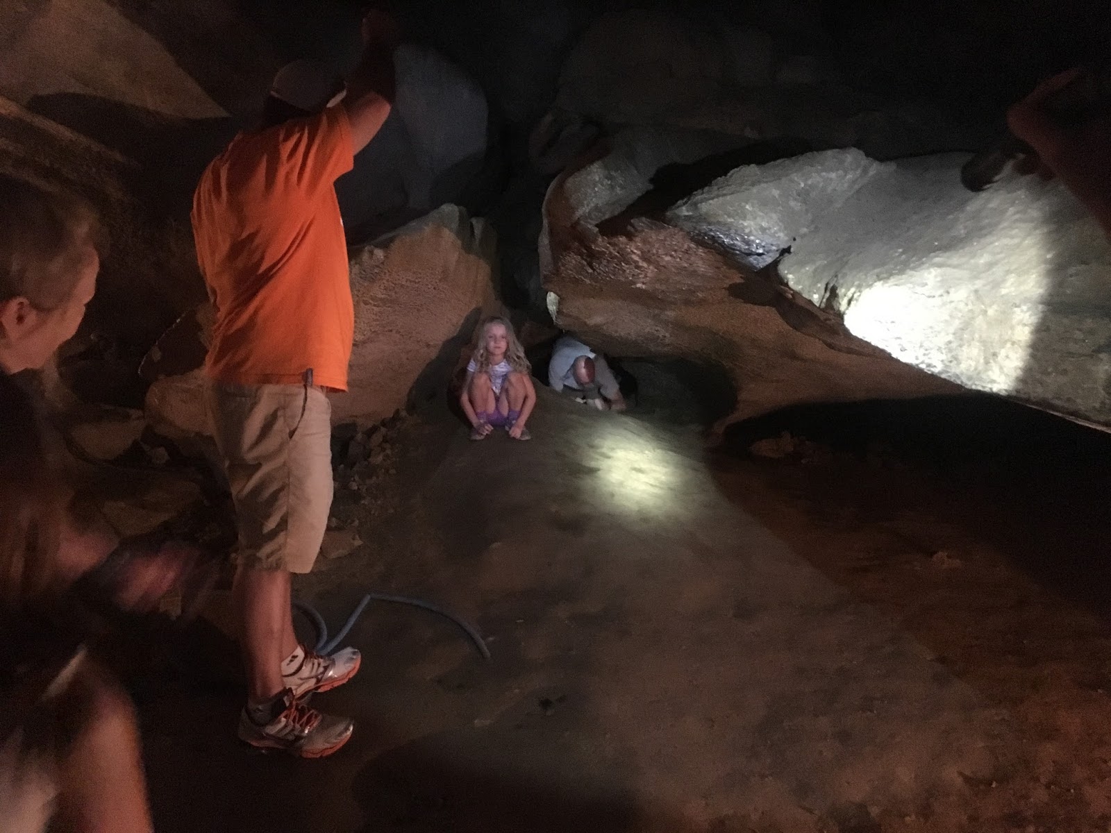
Unlike most commercial caverns where touching is not allowed (lest your hand leave a layer of slime that stunts the growth of stalactites and other cool formations), much of Appalachian Caverns is open for exploration. They even offer a mud-tour, which is exactly what it sounds like - bring old clothes because they'll have you crawling through every nook and cranny you can fit into, and possibly a few you can't. Our guide welcomed the kids to a taste of this by letting them crawl through this tunnel, and since I didn't see any signs defining what they considered a "kid", down I went after them.


The first half I managed pretty well but it soon pinched me down to my stomach, and only the combination of my breakdancing worm skills and my nephew's encouragement got me through the last squeeze.


An even more unique thing about Appalachian Caverns is that they have a mascot, a cat that is given free reign of the caverns and pops in and out of view throughout the tour. In additionally to that furry guy, one of the pools featured a couple large turtles, and unlike the cat they were happy to stop and pose for our pictures.


Any day spent wandering an underground tunnel is a day worth getting out of bed for, and thanks to the handiwork of a river that millions of years ago dried up, this day was just that.


It was great to do some exploring during our vacation, but it was even better spending time with family who I don't get to see nearly often enough. If anyone is to blame for my own sense of adventure, it's those two in the bottom right corner of this picture. Whereas too many people go into retirement with the mindset of, I've finally arrived, now I get to relax, my parents went into their twilight years full speed ahead, still looking toward the future rather than over their shoulder at the past. Always ready for that next chapter in life, this one has brought them to brand new state and an area that's full of fresh experiences to be had, and when you're the original Rondinone Adventurers, what else could you ask for in life.


Links:
Virginia Creeper Trail
Appalachian Caverns

Wednesday, September 6, 2017

Curious Graves of Massachusetts - Nathaniel Thurston's 7 Wives


This adventure began with a casual conversation between my wife and I one night, involving a subject that is very near and dear to her heart - graveyards and tombstones. In the midst of the chit chat something triggered a memory with me, and I asked her if she'd ever heard about the guy in Massachusetts who was buried with six of his young wives, each of whom had somehow died in their 20's or 30's. She gave me about a five-second blank stare, then made me slowly repeat what I'd just told her - that six of this man's wives mysteriously died at a very young age, and now the whole group of them were buried alongside each other at a cemetery in Massachusetts. There's a boatload of questions a statement like that could lead to, but my wife followed it up with just one.

And we haven't been to see this grave ... why??

I didn't have a good why to respond with, so that's how two days later we found ourselves driving to the Bradford Burial Ground in Haverhill, to look for the grave of Nathaniel Thurston.


If you trust what's written on his epitaph, Thurston was a well respected member of the community who was involved in local legislature for many years, and not the type of person one would suspect of rubbing out a wife every few years or so when he got tired of waking up next to her. Taking everything at face value, he would appear to be just the world's unluckiest man when it came to the life expectancy of the women he wed.
For many years he was a
member of the Legislature,
was distinguished for his benevolence
and greatly lamented by
his friends


Unlucky indeed, for between the years of 1790 and 1808 six of Thurston's wives passed away, an average clip of one death every three years. I'm not looking for any of his descendants to come beating down my door with pitchforks, however, so rather than accuse the man of being New England's version of Henry VIII, let me simply present the facts of Thurston's curious love life as they happened:


1780 - Married Elizabeth "Betsey" Thurston, who died on November 25, 1790 at age 34.


1791 - Married Martha Thurston, who died on May 12, 1799 at age 32.


1799 - Married Huldah Thurston, who died on September 8, 1801 at age 24.


1803 - Married Clarrissa Thurston, who died on November 14, 1803 at age 36.


1804 - Married Martha B. Thurston, who died on July 27th, 1804 at age 25.


1804 - Married Mary Thurston, who died on March 3rd, 1808 at age 27.


1801 was a particularly cruel year in the Thurston household, for not only is that the year wife Huldah died, but a son she and Nathaniel had passed away also. Benjamin Thurston was only 8 months old when he died on March 7th of 1801, just months prior to his mother's demise.


Between 1803 and 1804 was another flurry of activity, as Thurston was married three times and widowered twice in a period of just over 12 months. As a testament to whatever charisma he had going for him, as quickly as the man could bury one wife he somehow attracted a new one. Not only that, but the older he got the younger the girls were that he landed. Thurston was pushing 50 years of age when he wed wives 5 and 6, each of whom were only in their mid-20's at the time.

A cooling off period followed this sixth marriage to Martha B., and they remained a couple for approximately four years until she too died at 27. This was in 1808, and without skipping a beat the 54-year old Thurston was married for a 7th time to 25-year old Frances Fletcher in 1809. That is where the craziness finally came to a stop, as Thurston passed away in 1811 with wife number 7 still alive and well.

I'd bet my Jeep there's a whole lot more to this story, but I don't know how to investigate a 200 year old cold-case therefore it ends with Frances having done something none of the other wives were able to do - outlive Thurston. And as a result of that accomplishment Frances distinguished herself from the others in another way as well, she is the only wife who will not be spending eternity next to Thurston, alongside wives 1 through 6 at the Bradford Burial Ground in Haverhill Massachusetts.


Links:
Unedited Group Photo

Friday, August 11, 2017

The Georgia Guidestones


Most of what we write about is here in New England, but sometimes we visit a place that is just so darn cool we need to share it, even if it is a thousand miles away. Such is the case with this next adventure. Do a Google search on this monument and you'll see it referred to as everything from instructions on how society should recover from an apocalyptic nuclear war, to a series of messages from the Illuminati on how they plan on taking over the world, and even as the ten commandments of the Antichrist and something that should be destroyed immediately. If you're a fan of late night radio shows about the unusual you will already aware of this place, and need no introduction to the Georgia Guidestones.


It's hard for me to imagine anyplace in the United States more shrouded in mystery and controversy than the Georgia Guidestones, starting with the question of who it was that even masterminded their construction. To hear that we don't even know who had the thing constructed might put images in your head of it being hundreds or thousands of years old, but here comes your first twist. The Georgia Guidestones were built in 1979 and unveiled in 1980, well within just my own lifetime. We even know who physically built it, that was the Elberton Granite Finishing company out of Elbert County Georgia. But with that statement you are now fully up to speed on how this thing got here, for nobody knows who it was that hired Elberton Granite to build it. And don't bother knocking on their door, they don't have any more of an idea than the rest of us. Money and very specific instructions were given to them through a series of third party transactions, and like any good business they honored their customer's wishes and built the structure accordingly.

Let me start at the beginning. In 1979 a man under the admitted alias of Robert C. Christian walked into the Elbert Granite company and said he wanted to hire them to construct a monument, featuring several massive stones that would stand as tablets and have messages carved into them. Each stone would be much larger than anything the company had dealt with in its history, and in addition there were several astronomical requirements for how the stones needed to be arranged. To top off all this craziness, the man wanted to do this as the anonymous representative of "a small group of loyal Americans". The owner of the granite company was later quoted as saying that he thought he had a real kook on his hands, so to get rid of him he quoted a price many times higher than any job he'd ever done, then shooed him off to his banker to work out payment. The man left, and the owner figured that was the last he'd see of him, but a week later news came from the bank that a $10,000 deposit had arrived for the job. Kook or not, at this point the man was a paying customer so it became business as usual for the granite company, and off to work they went.

Requiring more than just the usual stonework they were accustomed to, Elberton Granite enlisted the help of an expert from the local university for the astronomical requirements of the Guidestones, which included a sight hole for viewing the North Star, a sun-slit through the top stone that at noontime would shine on whichever day of the year it was, and some always popular solstice tracking holes bored through the giant slabs. But while these were a few of the fun features of the stones, the monument also came with some less whimsical aspects. Below is the first of the Guidestone's 10 "commandments", carved into the tablets in 8 different languages. Although some of these commandments preach the type of stuff most of us can get behind, such as Prize Truth-Beauty-Love, this first one downright scares the heck out of people.
Maintain Humanity Under 500,000,000
In Perpetual Balance With Nature


Maintain the population of Earth at a half-billion people. Here's some quick math to let you know how you'd fare under this particular rule. Siri tells me that our 2017 global population is just a tick over 7.5 billion people. To reduce the world's population to 500 million as instructed, only 1 person out of every 15 would be allowed to continue living, the other 14 would be eliminated. Of course these are just some silly words carved into a rock, but not to everybody there are, and there you have the Illuminati portion of the conspiracy. Many people believe this secret society not only controls the strings of the world's most powerful governments, but is actively pursuing ways of reducing our global population. Poisonous chemtrails, HAARP weather control, tainted fluoride in our water - if you ever need a reminder of just how sane your own life is, grab a couple beers and spend the night on YouTube looking up the terms "population control" and "new world order". Just don't blame me if life suddenly feels very boring afterward.

The flip side of this argument is that the 500 million rule is directed toward a society that has devastated itself by nuclear war, and done this paring down of humanity already. This is a fairly popular theory among those who've studied the Guidestones, as not only were they constructed during the height of the Cold War, but several other commandments seem fitting for a post-apocalyptic world as well. Ignoring the fact that I have no idea how to angle my pictures to avoid shadows, here is the English version of the Guidestone's 10 rules for society:


So if all this took place in the years 1979 and 1980, what in the past 37 years has been learned about the Guidestones and who built them? Unfortunately (or fortunately, depending on your preference of these things) not much. Not a single claim from the group of "loyal Americans" has been made during this time. And the mysterious Robert C. Christian, representative of the group and negotiator of the deal? Only one man in the world is confirmed to know Christian's true identity, and he's not spilling the beans. Wyatt Martin is the banker Elberton Granite originally pawned the "kook" off to, and as part of establishing the account that payments would flush through, Martin insisted on knowing Christian's real name. Christian obliged, but only under the condition the banker sign a non-disclosure agreement, something that Martin did and remained true to this day on. The two actually became friends of a sort, or pen pals, and for years corresponded through good old fashioned letters. Ever the mysterious, Martin claims that no two letters from Christian were ever mailed from the same location. Then in 2001 Christian went silent, and being that he was older than the banker, Martin speculates that this is when Christian passed away.

I made my journey to the Georgia Guidestones in the midst of a business trip to South Carolina, in which I was able to squeeze in an extra day of flying in order to make the drive over. Fortunately for me I was travelling with someone as imaginative as I am, who saw no issues with spending 5 hours cooped up in a car in order to spend 15 minutes looking at a monument. And to say it was worth such a long car ride is an understatement. The details of that ride have long since faded, but the memory of standing at the base of the Guidestones and absorbing all the secrecy, controversy, and intrigue that has surrounded them all these years? That's something that will stay with me as long as I still have wits enough to appreciate all the mysterious things our world has to offer.


Links:
Location of Georgia Guidestones on Google Maps

Saturday, August 5, 2017

The Old Stone Church - A Lone Survivor's Abandoned Shell


West Boylston Massachusetts today is not the West Boylston it was 150 years ago. In the 1800s this was a developing factory town with businesses up and down the Stillwater River, but if you drive the stretch of Route 140 today that runs through this former hotbed you won't see any of those structures remaining - the factories have long since been destroyed and the houses either moved or torn down. But what you will see are two impressive and very different things, and whose histories are intertwined. One is an extremely large reservoir that helps serve the modern day city of Boston, and the other is the remains of the Old Stone Church, which stand on the banks of that reservoir.


In the 1890's construction of the Wachusett Reservoir was an inconvenience to many surrounding towns, but none more so than West Boylston. The reservoir's creation forced the closing of factories that depended on the river, devastating the community and sending many residents packing to look for work elsewhere. It wasn't until years later, when use of the automobile became commonplace and the town found itself as a handy little bedroom community to the city of Worcester, that it began attracting residents again and a new epicenter of town was born.

But through this decades long ordeal one building remained, spared the wrecking ball by its beauty to West Boylston's residents and attraction to visitors of the town. The Old Stone Church.


This was actually the second church to be built on this site. In 1832 the original was constructed for the West Boylston Baptist Society, but on May 2nd 1890 - a bad day for churches - both this and a neighboring catholic church burned to the ground. It was quickly rebuilt, but by 1902 was forced to close for good due to the reservoir's construction, an inconvenience for which the Baptist Society was awarded $22,000 by the Metropolitan Water Board. The structure was gutted and left empty, and that is how it remains over 100 years later when we took our family to see it.


Having been inducted into the National Register of Historic Places the church is open to the public, and wandering throughout its dirt floors and support beams feels like a little bit like walking through a ancient ruin. The empty windows also proved to be just the right height for a couple members of our group to hang out in.


In one of my more fanciful breaks from reality, I came here with the idea that I'd somehow be able to scale the inside wall of its magnificent bell-tower.


But I don't shoot spider webs from my wrists, and as such never made it more than a few feet off the ground. I could only imagine how great the view would be from the top.


Our visit coincided with a wedding party that made the really cool choice of having their photo shoot taken here, and although they clogged up the main entrance for much of the afternoon, the kids were able to moan and groan about family pictures just as well from the church's side entrance.


This is not the type of place most people would spend an entire day at, but if you even find yourself near central Massachusetts it's definitely worth the detour to walk around and enjoy its beauty, both inside and out.


Just head down Route 140 in West Boylston and look for the giant flag, you cannot miss it.


Links:
Location of Old Stone Church

Saturday, July 29, 2017

Paddock Mines - Exploring Shaft #2


If anything can stir my imagination more than a hole in the earth, high up on a desolate mountain and disappearing into darkness and the unknown, I don't know of it. Whether it's a forgotten cave, a hundred year old mineshaft, or even a mile long abandoned tunnel if you ever find yourself in southern Pennsylvania, to walk underground in one of these places it to step out of one world and into another. And in the case of the Paddock Mineshafts, you're stepping into a world of men who dug through rock for twelve hours a day with nothing more than a pickax and grit, men who were oblivious to such modern luxuries as OSHA safety and mid-morning coffee breaks, and men who would have laughed me right off the mountain with my daily multi-vitamins and two puffs of a inhaler every morning.

Our follow-up expedition to the Paddock Mineshafts has been my most anticipated adventure in the short history of this blog. After learning there was a second and equally long tunnel in those treasured woods, we planned a group excursion with the WeRmudfun gang to go back and explore everything in one shot - both the tunnel our group found during our initial search, and this existing one they knew of that we'd been looking for but never came across.

The morning actually started on a down note, as we left the house with only two of the four people who were committed to going from our group, me and Barry. Feeling bad for the two that couldn't make it, but not bad enough to consider rescheduling, we drove the two and a half hours to our designated meeting spot, roughly a mile's distance further along an old dirt road from the first time we made this trip.

Because we were now running off GPS there would be no bushwhacking through thickets and thorns like our previous search, and it couldn't have been more than half an hour of enjoyable hiking and chatting until we reached the mine. This was the first hike on this trail for our group, and the first hike in over two years for our new friends, who were navigating the way. My only flub-up was when I struggled to make small talk and asked them if the random section of trail they we were leading us through looked familiar. You know, from their last trip here over two years ago.

We arrived at the mine and one of the first things we noticed was that unlike the previous shaft, which had quicksand disguised as a puddle and would swallow you whole at the entrance, this one's method of attack was a slow and more tortuous one. Soon after entering the mine, a foot-deep river of cold water stood throughout much of the tunnel, and there was no way to avoid walking through it. A problem for some people perhaps, but no match against the Walmart waders I'd picked up just that morning.

But similar to the previous shaft, this one's entrance is guarded by some nasty spiders that seem to be breeding an army of their own.

Once about halfway into the mine the water eases up and the shaft becomes pretty smooth sailing. It runs mostly in a straight line, but has just enough waviness to close you off from any last glimpse of daylight and give you a real sense of twisting through the mountain.


Unlike shaft #1, this one doesn't abruptly end at a wall that makes it obvious you're not going any further, and instead splits into two directions that are almost immediately caved in on both sides. Purposely or not we don't know. And although I gave it my best shot to crawl over one of the piles of rubble, there just wasn't any continuing. On a related note, I'm one of those guys who will stop to say cheese for the camera under any circumstances.

Now it was on to the second part of this adventure, the Paddock Pit, and what turned out to be my biggest surprise of the day.

When I was considering that we would be climbing down into a vertical mineshaft, I mistakenly assumed it would be a shaft with a steep decline, and that we'd just need some rope to guide the way and help steady us down. Nope. A pit means a pit, and in this case it means a hole wide enough my wife could have driven our car into it. You can imagine how silly I felt standing at the edge of this thing holding not much more than a clothesline, but I threw it down anyway because if nothing else it would give us a measurement of how deep this hole went. We heard the plastic spool smack the bottom just before we ran out of slack at the top. That was a fifty-foot stretch of rope we'd just heaved in there, and this pit had swallowed almost every last foot of it.

It was time to head home for us as we knew we wouldn't be getting into the pit on this day, but at least I knew exactly what we were challenged with now - finding a way to climb straight down into a fifty-foot hole in the earth. Off to the drawing board I would be going.

And you know what that meant ... another trip to the Paddock Mines would soon be in the works.


Links:
Searching For The Paddock Mineshaft - Part 1
WeRmudfun - Abandoned Paddock Mines Shaft 1 and 2