Sunday, May 21, 2017

Roaming The Crypts Below Boston's North Church


One If By Land, Two If By Sea.

As our guide spoke these words I recognized them in the dusty, high-school part of my brain, but I never could have placed where they were from. Some old poem by some old, bearded poet would've been my guess - and surprisingly I'd have been right - but I didn't know any of this until our recent trip to Boston's North Church. This phrase represented a warning, one that was memorialized in the poem Paul Revere's Ride by Henry Wadsworth Longfellow. One if by land warned that if the British soldiers were attacking by land one light would be lit in the church's steeple, and two if by sea warned that the British were attacking by the quicker route of rowing across the Charles River. Two is the number of lanterns that hung from the steeple on April 18th, 1775, and with this warning Paul Revere and over thirty men on horseback (I'd been misled in school, it wasn't just Paul Revere himself) spread word all the way from Connecticut to New Hampshire of the British attack.

This historical church broadcast that warning over 200 years ago, and although the original steeple has long since toppled in a storm, the group who restored it only adds to the lore of the story.

The tower was our first stop upon entering the church, and because we'd signed up for the behind the scenes tour we were able to bypass the commoners and head up this rickety staircase marked no admittance.

Ascending into a steeple that had touches of both historical times and modern day, we next learned about the specialized art of bell ringing. This steeple has six bells, and you'd better make sure the phrase Master Bell-Ringer appears somewhere on your resume if you hope to put your hands on these ropes. At this church at least, ringing the bells is like playing an instrument, something each person trains at and is privileged to be chosen for. Their bell-songs are scripted, and together the band rings their music throughout the city at specific times.

Music lessons complete, it was now time for the real reason I'd taken a day off from work to come battle the crazies of Boston's rush hour.

On to the crypts.

Beginning in the 1700's it was common practice for North Church to bury its dead underneath the building, and today an estimated 1,100 bodies (nope, no exact count) are sealed in vaults that hold an average of forty bodies each. That's pretty efficient packing given the size of this empty crypt we saw, which I only dared enter because there was no door on it for Tina to seal.

Occupied crypts were marked by small doors, which lined both sides of a corridor that ran square throughout the basement.


Sometime around when the civil war was heating up the city decided maybe this wasn't the most sanitary thing people could be doing with the dead, and they ordered a stop to the practice. No more bodies were to be buried indoors. Not willing to give up the revenue stream so quickly, however - since the crypts made it easy to discard of old remains and make room for new ones, more and more often the church's larger doners - they ignored the city and continued stuffing their crypts with fresh bodies. This eventually led to the city entering the church and sealing the crypt doors with concrete, forcibly putting an end to the practice.

Although most of the concrete is gone today some crypts have only partially crumbled, revealing how the city tried to hide them so many years ago.

Exiting the crypts and returning to both sunlight and present day America, we continued our afternoon by visiting the main section of the church and its unique seating arrangement. This layout reminded me of a cubicle farm I once worked in, the memory of which gave me a nastier chill than any of the crypts.

On our way back to the car we made one last stop at a place that had caught our eye earlier, the church's cemetery, and there we found this final curiosity. Nearly every one of these old gravestones was adorned with a skull and crossbones, much like the one in this picture below. I don't yet know the significance of this (other than the obvious), but on a day whose theme ran heavy with the macabre, we couldn't think of a more fitting way to end our visit.


Links:
North Church Behind The Scenes Tours


Saturday, May 13, 2017

Curious Graves - Captain Jones' Leg


Twenty-seven states in America have a town or a city named Washington, and until a few months ago I never knew that New Hampshire was part of that list. If we hadn't been on the hunt for a particular gravestone recently I would still be ignorant of that piece of trivia.

The grave we were looking for belonged to Captain Samuel Jones, a man who moved to the rural town of Washington, NH in the year 1800. Various accounts describe that in 1804 Jones was helping to move a building when an accident occurred. (The fact that two hundred years ago people were moving a building without heavy equipment is something these other authors took in stride, but I'll get my head around that one another day.) During this relocation Jones' leg became pinned between the building and a fence, mangling it so badly he had to have it amputated.

Captain Jones then did what any reasonable person would do with a limb they'd lost in a violent accident, he held a funeral for it and buried it in the town's graveyard.

We went searching for this gravestone knowing only that it was somewhere in the town of Washington. Being such a small place - population just over 2,000 - there weren't many cemeteries to deal with, so our master plan was simply to drive into town and begin searching each cemetery row by row. The only specific clue we had was that if you stood at Captain Jones gravestone and looked up you would see a large ball gravestone on top of the hill, with the punchline being that the ball gravestone is the plot-marker for the Ball family grave.

It wasn't until the third and final cemetery that we found the Ball gravestone, and we thanked them for the laugh.
With the last name Ball, what else would you choose for a gravestone?

But we still didn't find the Capt. Jones' grave, and worrying it was turning out to be a myth I began convincing myself that the Ball's gravestone had still been worth making the drive for. There were farther away sections of this cemetery, though - as in across the road and down the street, beyond where it was supposedly located - but going all in with our search we spread out to cover them as well.

It was there that I stumbled across this smaller stone, and it had me at "Capt."

We later realized that the author we'd been relying on had never visited the site himself, because Jones' gravestone and the Ball family gravestone are nowhere in sight of each other. That was okay though, half the joy has always been in hunting these treasures out the hard way. My excitement from seeing it after two hours of searching was far greater than it would have been if I'd simply strolled up to it by GPS. After taking turns posing and chuckling over the fact that it actually does exist, Tina and I had a very satisfying 90 minute drive home.
Yes, we drove a 3-hour round trip to find this gravestone

Related Links:
Curious Graves - Persecuted For Wearing The Beard

Sunday, May 7, 2017

Searching for the Paddock Mineshaft - Part 1


Had video of it not existed online I would have considered it the stuff of legends. A tunnel leading hundreds of feet into the mountain, another inaccessible one dropping 50 feet into the earth before disappearing sideways into the darkness. These were mineshafts I'd expect to find in the hills of Arizona, not in our little corner of the country, and I was determined to find them. But other than the video - which smartly kept their location secret - I'd only been able to muster up a single lead, directions to an old mining road in northern New Hampshire where we were to park at a red/white trim cabin, find a trail alongside it, and locate the mineshaft a quarter of the ways up the mountain.

Let's start with the basics - mountains are big, and even finding a giant hole in the earth is daunting when you don't have any idea where you should be looking on one. But deciding that the bigger the reward the bigger the challenge we were willing to undertake, a handful of us made the 2-1/2 hour drive north early one Sunday morning. We found the cabin and trail next to it, but within minutes were hit with our first pickle. The trail branched off, and not just once but several times. Figuring our best odds would be sticking to the main trail, we followed it up as we scoured the mountainside for the opening. Even after well past the quarter-way mark we stuck with it, and the longer we searched the more convinced we became that it was probably back down off one of the side trails. Partly out of frustration and partly to show off that look, I'm not tired, I ran the final portion to the summit. There was nothing even resembling a mineshaft.

With four of us in the group our next idea was to police-sweep the face of the mountain as we worked our way back down. Spreading out to where we could just see one another we bushwhacked through thorns and muck, occasionally calling out in the hopes that something looked promising. Nothing did, and we eventually found ourselves right back on the bottom trail, sweaty and dejected. We'd been at this a couple hours now and decided to start heading home and try our luck another day. My friend Dave had a little more ambition than the rest of us, though, and as we trudged back to the car he made several quick off-trail searches, never giving up. It was on one of these dart-offs that we heard him call out how beautiful it was, and that's how minutes later we found ourselves standing at the entrance to the Paddock mineshaft.

Although we went on to explore the entire tunnel that day, what happened next put an end to my picture taking and turned my beautiful iPhone into a $600 paperweight. As you watch this video listen for my buddy's eerie premonition, as well as my daughter Madison's true priorities at the end when all hell broke loose.

This cesspool sits stagnant for months on end and is home to the digestive tracks of countless frogs and other small animals, and I'd just spent a ten count marinating in it. The gang helped me out and I was able to bypass it and continue into the mine, and although later they wouldn't let me into the truck until I'd taken a water bottle shower, the day was still a great success. So much so that we revisited the site just a few weeks later when I was able to properly document the visit, starting with our extremely careful crossing of the mouth.

For all you arachnophobes out there, the waterhole wasn't the only deathtrap waiting for us at the entrance. We counted probably two-dozen of these spiders along the opening, and each one guarded a white nest that I don't ever want to know what contained. If one of those things had popped open I was ready to jump back into the sinkhole for safety.

Once you're about 50 feet deep the tunnel is mostly dry, and unless your name is Barry you can safely walk along without having to worry about cracking your head.

It doesn't take long before the fading entrance has you feeling completely cut off from the outside world. In addition to arachnophobes and cesspoolophobes, claustrophobes are another group that would do better to stay home the days we go on these expeditions.

Abruptly we reached the end of the tunnel, and it almost hit me as a letdown. There were no ancient treasures, no lost city of gold, just a rock wall where a hundred years ago men had stopped digging and packed up their tools forever.

The Paddock mineshaft was a fascinating discovery, and one that only get's better. After reviewing our pictures that night, Barry noticed differences between the opening of our mineshaft and the opening of the mineshaft on YouTube. We contacted the group who posted that video, and after comparing notes pieced together the fact that these are two completely different shafts about a mile apart. We had found a tunnel they didn't know about, and their tunnel was still waiting in the woods to be explored.

And you know what that meant ... another trip to the Paddock Mines would soon be in the works.

Saturday, April 29, 2017

Exploring An Abandoned Scout Camp


Abandoned places are one of my very favorite things to explore. They are a snapshot in time, each with its own unique story to tell. Sometimes these are just pieces of what once was, such as with Madam Sherri's Castle, while other times they remain fully intact but forgotten. This is the case of a scouting camp I recently explored around a lake in eastern New Hampshire. It sits untouched, but it sits alone and forgotten.

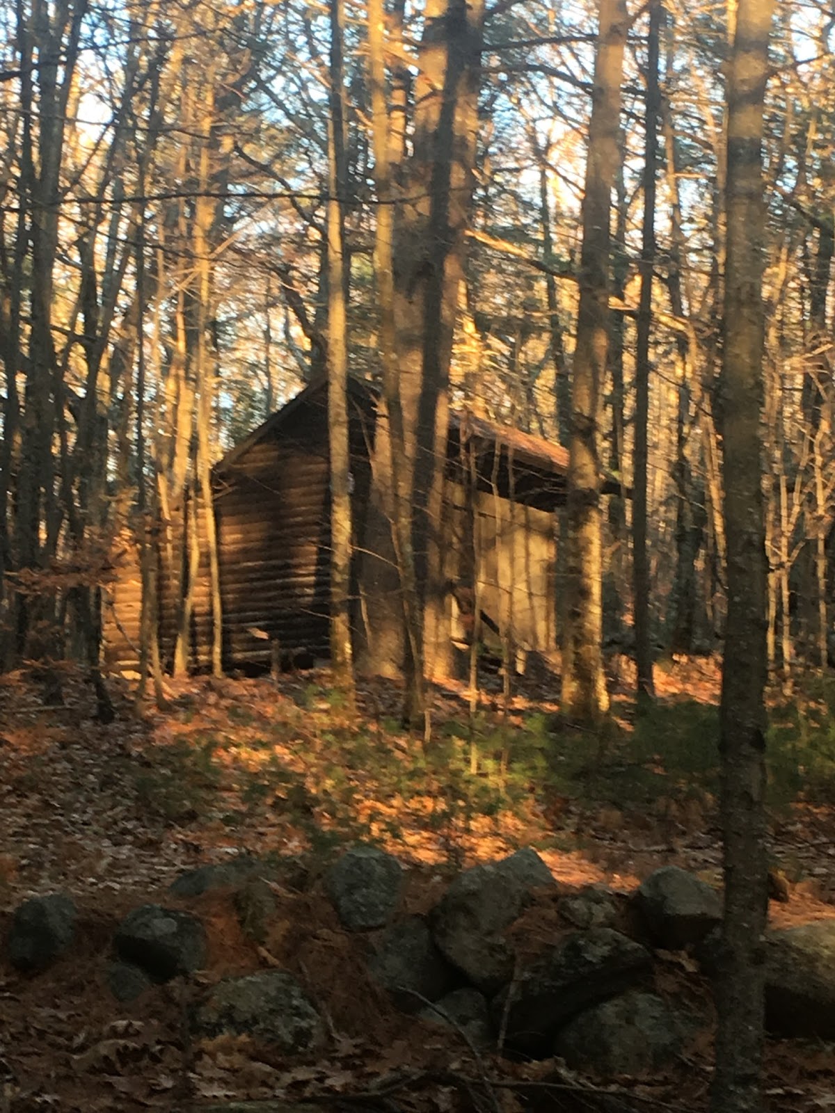
As you would expect of a youth camp, this one's situated in a fairly secluded area of woods that would be perfect if there were ever a sequel to Friday The 13th, New Hampshire edition. Riding my mountain bike down a trail I should not have been on, the first thing to greet me was this crumbling shack and stone foundation. It would be maybe a quarter-mile before the first of the bunkhouses appeared, which made me wonder if this structure was unrelated to the camp. I now believe it was, for as I learned throughout the afternoon this is an area of woods that has lived more than one life.

After passing a couple side trails that I promised to return and explore another day, I spotted the first of the camp's cabins through the trees. It was boarded up but in sturdier condition than the sunroom we tore off our house a few years back.

There was a time when hiking these woods was allowed and people were free to walk among - but not inside - the cabins. That changed many years ago however, and the entire property is now marked as no trespassing. Once again I am guilty of this crime, but once again I was careful to take nothing but pictures and leave nothing but footprints. Or in this case, bicycle tracks.

I also witnessed the kinds of activity that led to this unfortunate decision to kick out the public.

Beer, peanut butter, and Smuckers. Tough to think of a more well-rounded diet than that.

I pride myself on being a pretty good Internet sleuth, but I pretty much laid an egg when trying to dig up information on this place, when it operated and when it shut down. I found a couple newspaper articles referencing jamborees here in the 70's, but nothing more recent. It's certainly been a long time since any kids have enjoyed chucking each other off of this dock.


Sitting on a hilltop that looks down over the once teeming lake, this cabin once had the vest view of the camp, and by the char-coaled logs in the firepit it's clear there's still a few people stopping by to enjoy the view every now and then. Maybe while enjoying a Budweiser or two?

I followed signs that have long since faded but at least gave clues as to which trails had things to see down them.

Which eventually led me to this larger cabin, which I'm guessing to be the counselor's bunks.


And not far from there, the mess hall. And a lesson. The bad thing about taking pictures alone is that nobody is there to remind you to take off your helmet because you look like a dork.

In total I found somewhere around a dozen structures (counting a couple outhouses), but I also found remnants of the life this land lived prior to the scouts moving in. This included several more foundations such as this one.


And the bonus find of the day - plus an indication of how far back this land dates - this 1800's cemetery sitting a short ways off the main trail. It took me a minute to figure out what was unusual about it, but I realized when approaching there was no entrance built into the gate, so to get a closer look I had to swing my leg over the top bar like Andrew The Giant entering the ring.


These woods are rich with history and a fascinating place to explore. With the foundation ruins and family cemetery I imagine this was once a vast farmland like much of old New England. Then the crops went away and the scouts took over, and however many hundreds or even thousands of teenagers enjoyed hiking these trails, swimming in what used to be a lake, and making friends from all over the state. As a child scout myself I took many weekend trips to places such as Camp Carpenter in Manchester, and although the specifics of those trips have faded with age, the enjoyment I remember - from the excitement leading up to them, to the adventures and fun when they came - has only grown more pleasant.

Somewhere in New Hampshire there are people who have these same nostalgic feelings when thinking back on this camp, and if I were Donald Trump rich I like to think I'd buy these woods simply to create a hiking preservation and open it to the public, letting those people walk the land and, for a day, revisit the memories of their childhood.


Saturday, April 15, 2017

Little Niagara and the Foss Family Cemetery


Tucked away in the woods of Strafford New Hampshire, a half mile hike beyond where a dead-end dirt road meets the forest, is an impressive little waterfall that looks like something more likely to be found two hours north in our White Mountains.

We visited Little Niagara while on the hunt for abandoned cemeteries, and having heard there was one in these woods we made this stop on a cold day in January. Our only objective was to scout the area and figure out the parking situation so we could return during warmer weather and make the hike, but once there it was hard not to at least get out and take a peek. It was much too chilly for Madison so she waited in the Jeep, then Tina felt guilty and decided to wait with her, so promising not to be more than 5-10 minutes I scooted down the trail alone. A half hour later I returned with enough cool pictures for Tina to plan a return trip just a few weeks later.

This trail is more than just a means for hiking out to Little Niagara, there's history in these woods. Before we'd even made it a hundred feet Tina spotted an old foundation beyond the rock wall that parallels the trail. For anyone who attempts the hike someday, locate the stone I have circled and you'll find an old Italian coin I placed underneath.

Continue another ten minutes and you'll find the cemetery that originally brought us to these woods, the Foss family cemetery. Like an excited child going to the park Tina ran the last dozen steps to check out the gravestones.

We spent a few minutes poking around and trying to read them, but once Tina determined there weren't any spirits to be awoken we hit the trail and hiked the remaining distance to Little Niagara. Although impressive from the top, the really good view is to cross over and see it from the bottom. Only trick is that to cross over you'll have to maneuver this gap that once held an actual bridge, but now requires you to tight-rope across these logs.

And although we're planning a return trip in the spring where we can enjoy the area more leisurely, I'm thinking this is probably the best time of year to visit, when the snow is melting and the water rushing. For size perspective, here is Tina standing at the top of the falls. I know I kinda cheated by using the smallest person in our group to make the falls look even bigger, but they'd be impressive no matter who was standing there.


Little Niagara was the perfect hike for a winter afternoon when we needed to clear some cabin fever, get the young one off the computer for a few hours, and really make us start counting the days until spring.


Coordinates:
Parking: 43.3317, -71.15007
Cemetery: 43.32989, -71.15437
Little Niagara: 43.32602, -71.15717


Sunday, April 9, 2017

Fort Warren On George's Island


On a warm, sunny day in the summer of 2016 our family took a 40 minute boat ride through the Boston Harbor to explore Fort Warren. And on a bitter-cold day six months later after receiving nearly 2 feet of snow in a blizzard, I decided what better time to try and recapture the feelings of that beautiful day.


Dedicated in 1847 and completed in the 1860's, Fort Warren is by far the largest and most fascinating fort we've visited in New England. It is situated on George's Island in the Boston Harbor and the boat ride alone is worth the trip out there. We sat on the upper deck of the Brant Point Ferry and enjoyed a narrated ride by a host that was one-third tour guide, one-third historian, and one-third comedian.

Arriving at the island we almost felt overwhelmed with where to begin, and I found myself sizing up the place while at the same time counting hours until our boat ride back, trying to decide how fast we'd need to whip through in order to see everything. We stopped just long enough to admire these guns at the entrance before heading into the pentagon shaped fort. Also, because I have very little knowledge of weapons, expect that I'll refer to anything from the smallest of pistols to the largest of bazookas as a "gun".

Going through the main entrance we found a winding stone stairway leading to the top of the fort where you can really take in the vastness of the island, which based on whether you're measuring at high tide or low tide will vary from 39 to 53 acres.


Fort Warren was built to hold 200 guns, and although most are long since removed a handful have been left sporadically throughout. Here is Logan barely able to contain his excitement at seeing one.


During the civil war Fort Warren served as a prison that was home to almost 800 military and political inmates. Most famous of these was then Vice-President of the Confederacy, Alexander H. Stephens, who spent 5 months captive on the island. More recently the fort served as a very brief holding cell for these two hardened rugrats.


Following the war and release of its prisoners, Fort Warren saw use as a training installation and went through a series of overhauls and upgrades. During WWI and WWII it served in our country's coastal defense, including being the control center for a mine field laid throughout the Boston Harbor. The fort was decommissioned in 1947, changed hands from the federal government to the State of Massachusetts in 1958, and in 1961 underwent restorations and was opened to the public.

Although most parts remain accessible I estimate that maybe a third of the fort was closed off from exploring, including the entire second level of the far side. But wouldn't you know, we visited at a time when for whatever reason a portable set of wooden steps was placed against an opening on the outside wall. Maybe they figured nobody in their right mind would climb these stairs and try crawling through a hole 15 feet in the air, but those people have never met my wife Tina.

And the next thing we know we were wandering through this long hallway that for some reason was off limits to the public.

It was down this hallway that I found what looked like a storage chest built into the floor, and because I was already breaking one rule by being here I decided why not break a second one and open the chest.

Of all the things I expected to find - weapons, war remnants, maybe a bunch of canisters with skulls and crossbones on them - what was inside I couldn't have guessed with a thousand tries. This large stone plague - and you're going to have to trust me on what it says because apparently I don't know how to use the flash on my camera - which reads "The Golden Rule, Treat Others As You Wish To Be Treated".

The Golden Rule - Treat Others As You Wish To Be Treated

I'm going to speculate on this sign and why it's on this island. During it's time as a military prison Fort Warren had a reputation as one of the most humane places to be held captive. When the warden's son was send to battle during the civil war, several confederate officers being held prisoner at the fort actually gave the son letters that, in case he should be captured in the south, urged he be taken good care of. Could this plaque have been one small representation of the leadership that created this culture? If so, why is it tucked away in this forbidden room rather than on display? Enough weapons were being shown off on the island's museum, surely they could make room for this. Or they could even hang it in one of the forts fascinating, never-ending corridors such as this one.

But that would be a mystery for another day. We backtracked across a field of goose droppings and enjoyed our boat ride to the mainland, which fortunately didn't feature any more tour guides. We loved the narration on the way there, but coming back was made for enjoying a peaceful ride through the harbor and reflecting on our day, and each of us sharing the favorite part of our visit to Fort Warren.


Links:

Saturday, April 1, 2017

Found! Catamount Hill's Lost Cave


Catamount Hill is the highest land in town. At the E. end of this hill is a precipice of 70 feet nearly perpendicular, at the foot of which is a cavern of some extent, inclining upwards. 

This 200 year old snippet was the only clue I had when I began my search for Catamount Cave in Allenstown, New Hampshire. Only a couple vague online references to the cave's existence are on the Internet, but even those are muddied by the fact that there's an unrelated Catamount Cave in Massachusetts that hogs all Google's attention. This lesser known NH version is on Catamount Hill in Bear Brook State Park, which at 10,000 acres and boasting over 40 miles of trails is the largest developed state park in New Hampshire. And as an area I've yet to familiarize myself with, I started my search the same way I start a good many of my searches - with Google Earth and a beer.

Having found things like trains in the woods or sections of abandoned highway from my laptop, I figured 70 feet of rock cliff would be easy enough to pick out from an overhead view. Sure enough, I found three separate rocky areas along the mountain that seemed like good matches, and on a recent Saturday where Logan suddenly decided an afternoon with his buddy at Blitz Indoor Park would be more fun than an afternoon with dad, I grabbed my hiking gear and headed west.

Knowing there is more than one entrance to Bear Hill, I drove to the road closest to where I'd pinned my suspect locations and found a trailhead conveniently right where I needed to find one. There I started up the trail.

After climbing about fifteen minutes and stopping to enjoy this view, I mischievously ignored the signs telling me to "stay on the trail or stay home" and followed my GPS into the woods.

One by one over the course of the afternoon I reached my pinned destinations and searched for a cave, and although I poked my head into plenty of suspicious looking areas like this one, one by one I was forced to check each destination off as being cave free.

To make things extra fun I came across these tracks which led to me carrying my pepper spray in my hand for the next half hour.

At some point it was closing in on 3pm and my thinking turned to heading home, deleting these dud locations and looking for new and better ones to search for on another weekend. On my way to the car I trudged, thwarted but not dejected, when I realized my front pocket was a little light. More good news; somewhere along the way I had dropped my flashlight. There goes $8 from Amazon, I decided. But after walking another 30 seconds I changed my mind - I really liked that flashlight, and I thought I'd have a descent chance of finding it if I turned back. My footprints would make it easy to backtrack, and finding a black flashlight on a fresh sheet of snow didn't sound all that tricky.

The good news is that fifteen minutes later I did indeed find my flashlight. The better news is that after plucking it from the snow I took the opportunity to walk a different route back toward the main trail, and that's when I came to this cliff.

Without measuring shadows and trying to triangulate the height of this sucker, I decided that yup this precipice looked 70 feet tall and I could check off the first part of the clue. Part two said the cavern was at the foot of the cliff, so moving left to right I search for possibilities until coming across this small opening. It was tight, so I dropped my backpack and crawled in.

The crevice went in maybe 5-6 feet before squeezing to a close. It was a cavern at the foot of the cliff and so technically everything matched, but I was not happy. If this little cubbyhole was the cave they'd been bragging about I was going to have a real beef with some dude from 1817.

Out I crawled, and to make sure I wasn't missing anything I continued to the end of the cliff. Then I saw a crevice big enough for me to actually walk into.

Suddenly there wasn't any doubt this was the Catamount Cave I'd spent all afternoon searching for. Here I am looking back from about 10 feet in, where I'd just risked pretty serious injury maneuvering over this triangle-shaped rock.

I rounded the bend but that's where the adventure ended this day. The cave continued, but there was a pinch point I was 90% certain I could get through, but not 100%. And since I was already breaking one of the cardinal rules by hiking alone, I decided not to push my luck.

At least I had found it, and triumphantly I exited the cave and made sure my GPS was still recording. For good measure I separately pinned the location on my phone, which had surprisingly good LTE service in these hills. Smiling like I'd just found King Tut's tomb, I hiked back to my car.

Now comes the fun part, gathering up some friends and planning a spring trip when the weather turns nice, to revisit and further explore the no longer hidden Catamount Cave.