Monday, October 24, 2016

Berwick's Mysterious Stone Tower


It's hard to imagine that a 20-foot stone tower could go largely unnoticed within the town it was built, but that's just what seems to have happened in our neighboring community of Berwick.

This adventure begins twenty-five years ago when I lived along the Salmon Falls River in Somersworth. It was just my second apartment, me and my friends were all poor, and for entertainment we spent much of our time hanging out along the river. A friend's grandmother had a small boat we had access to and we got to know those waters like our own backyard. We boated, fished, possibly caused a little mischief now and then, and spent many afternoons exploring the surrounding woods on the Maine side. And somewhere in the course of those explorations we came across this stone tower.

Unfortunately I didn't have the sense of curiosity then as I do now, and rather than wondering what the heck this thing was it simply became one of the many places we liked to hang out at. In those days we were interested in much more important mysteries such as could a Chevy Chevette get hangtime if you sped fast enough down the dirt whoop-de-dos next to the train tracks (it could, but plan on saying goodbye to your radiator), or how far up the river's drainage tunnel we could walk before it became too narrow to move (well past the manhole at the old Robbins Auto on Main Street, for anyone who knows the area). Eventually I moved away and the tower passed from memory.

Fast forward to 2016, and as a curious older man I start wondering what, if anything, has happened with that structure. I couldn't get to it by boat like we used to, so I made a few scouting missions through Maine and looked for any trails that would lead me in its direction. Not finding any, I picked a road where the abutting woods were the shortest distance as the crow flies to where I remembered the tower being, and on a recent Sunday afternoon I went for a hike.

It was maybe a mile I expected to walk, but the big question was how difficult it would be. The first half was actually enjoyable with the hint of a trail leading me alongside the river. Then I came to an intersecting stream which would normally have stopped my progress, but with our recent drought it was low enough to where I could rock jump my way to the other side. No trail existed on the far side of the stream, however, so there began my bushwhack. And although I can't remember where I leave my car keys or what I had for breakfast on most days, it wasn't long before I arrived exactly where I remembered it being a quarter-century ago.

I spent some time taking pictures and learning how to use the timer mode on my camera before reluctantly heading home, assuming this would be my last time seeing it. That night I searched every combination of phrases in my vocabulary for "tower" in the town of Berwick, but Google doesn't have a clue this thing exists. Somebody knows it's here though, for as you can see there is a clearing a hundred feet beyond where it stands that is being maintained.

So I emailed researcher James Gage, a local historian who wrote the book on stone structures in New England. Literally. James is co-author of A Handbook of Stone Structures in Northeastern United States, and since he'd graciously helped me with a previous location I was researching (a future post) I thought he may be aware of this one too. He wasn't, but he was interested and gave me a few clues as to what he thought it could be. He also ruled out my amateur's guess of it being a kiln furnace.

My next step was reaching out to the town of Berwick, so I wrote to the folks at the Old Berwick Historical Society. Within half an hour I received a very nice email from their spokesperson saying she wasn't aware of the tower but thought it fascinating. We talked back and forth a bit and she forwarded my emails and pictures to a handful of life-long residents for help.

That was this past weekend and now I wait, hoping one of these local historians can shed some light on Berwick's mysterious stone tower.

Links of Interest:
A Handbook of Stone Structures in Northeastern United States
Old Berwick Historical Society


*Edit*
I learned that the Old Berwick Historical Society (OBHS) is a separate organization from The Berwick Historical Society. I've been referring to them as one group and apologize for any confusion.  - Dave

Friday, October 21, 2016

Camp Nasty & Ralph Crocker's Ashes


As an adult, I once spent an entire summer in my backyard each night building a treehouse with my friend Barry. The appeal of having a clubhouse never left me from childhood, and as a first-time homeowner there were two things I wasted little time doing - first was buying a go-kart like the ones I used to drool over in the Sears catalog, and second was building that treehouse.

So when I learned recently about the "Spruce Swamp Beagle Club" - a group of guys who many years ago built a small cabin in the woods of New Hampshire - I immediately made plans to track it down. The cabin is called Camp Nasty, and armed with some general directions I found online a friend and I grabbed our backpacks one Saturday afternoon and headed out.

Our trek to Camp Nasty was a tale of two hikes. Part one was a leisurely, mile-long stroll down a snowmobile bed wide enough that my Toyota could have driven it. Part two was a bushwhack that featured impenetrable bushes, bug infested swamps, and at least a month's worth of bad language all packed into a half mile. Whatever trail once led to Camp Nasty is long gone (hence the cabin's name), and although we felt like giving up at different points we trudged on and eventually stumbled onto this welcome sight.

The first obvious thing was that, even if people still visited the cabin, it's probably been a long time since it's seen any meaningful use. Beginning with the broken front door that was propped up sideways, Camp Nasty is in a terrible state of deterioration.

What remains, however, are all the signs of a once place once treasured. Although no longer in usable condition, everything a person would need for an overnight stay remained. There were 2 bed frames, pots & pans, a table, lantern, and even a wood stove.

We signed the "new" logbook which dated to back to 1991, so people have been visiting this cabin for quite a long time. In fact, we later learned that this is the second cabin built on this spot. The first one was constructed from logs left behind by a tree cutting service but ended up burning down. Perhaps that explains this seemingly out of place smoke detector.

The builders of Camp Nasty loved their cabin and wanted to share it. They even wrote a mission statement welcoming people to use their "meager facilities" and asking only that it be left in the same condition it was found. One of the builders, Ralph Crocker of Exeter NH, loved this cabin so much he chose to be buried in it. Here is his cremation box which we found resting peacefully on a shelf. Holding his remains and thinking about the enjoyment this place brought him, I felt a momentary connection with someone I’d never even met.  

Later that night as I was flipping through the pictures, Tina commented how the cabin is on the verge of collapsing. What will happen if it falls down, she asked. I said I guess the pile of rubble will remain there until nature claims her back. But what about Ralph's remains, would someone come and get them? Maybe he has family that will come for them, I speculated, but more than likely I think they'll stay buried in the rubble until nature claims them back as well.

And although I cannot know for sure, I suspect that's just the way Mr. Crocker would have wanted it.


Tuesday, October 4, 2016

Pennsylvania's Abandoned Turnpike


Earlier this spring a friend asked me if I'd want to take a mountain bike ride with him that included traveling almost four miles underground. The answer I gave him was as emphatic a yes as I get when asking my wife if she wants to go for a double scoop ice cream at Lone Oak. Then he mentioned that this place was nearly a ten hour drive away, and after the slightest of hesitations my answer was still the same. Let's do it.

In 1968 a 13-mile section of Interstate 76 in Pennsylvania was carved off and rerouted around two mountains, which up until that point it had tunneled through. The interstate was a four-lane highway but reduced to a mere two lanes each time it entered a mountain, then opened back to four lanes when emerging the other side. Many would ask why a highway was built in such a curious way, however this interstate didn't start life as something cars were meant to drive on. It was originally constructed as part of "Vanderbilt's Folly", a reference to the over-ambitious and unfinished railroad construction attempted by William Vanderbilt in the late 1800's. And having been built for a railroad, these re-purposed train tunnels were never wide enough to be part of a major highway. So although a novelty to drive through in the early years, as traffic increased these bottle-neck entrances had commuters screaming for a fix.

A total of seven problem tunnels existed throughout the turnpike, and in an attempt to salvage them several were widened, or "twinned", to increase them from two to four lanes. This eliminated the bottle-necks for the tunnels it was performed on, and we actually drove through one of them one our trip down.

However, this proved too costly a solution and the decision was made to scrap the remaining three tunnels and build new interstate around them. One of the bypassed sections of road, which contains two of the tunnels, later became known as the Pennsylvania Abandoned Turnpike. Over the years it has become a destination for adventurers eager to make a journey underground. In fact it became so popular among bicyclists that control over nine miles of this bypassed section, including both tunnels, were given to a local cycling group, and today cyclists from near and far make the pilgrimage to Pennsylvania to ride the abandoned highway.

We made our own pilgrimage in June of this year. Our hotel room was conveniently located just a quarter-mile down the road, so we biked from our front door to where these cement barriers opened the way to our journey.

We rode the first few minutes in awe at how much nature had taken over this four-lane highway. The middle barrier was overgrown to the point we sometimes couldn't even see the gravel on the opposite side.

Between running and bicycling I've spent many years exploring new and different places, but I cannot think of a more beautiful sight than what greeted us a couple miles down the road. We came around a bend and there in the distance was Ray's Hill Tunnel.

Arriving at the entrance, we spent a good 10 minutes wandering around and taking pictures of its mammoth opening.

And listening to the hoots and hollers of tunnel-dwellers within.

Inside was a cold, wet, and dark world where we occasionally passed other hikers and cyclists. In the light of day encountering these same people was a friendly experience, but underground - where you can hear them but not really see them - everyone is a potential ax murderer. I'd find myself giving a quick "hey" into the darkness, then moments later peeking over my shoulder to make sure they weren't coming to "get" me.

3,500 feet later we triumphantly emerged out the other side, having conquered our first tunnel. We spent some time climbing and exploring the framework ...

... and admiring all the graffiti, which is plentiful at each entrance.

Once we were moving again it was perhaps three miles until we reached the longest of the seven original tunnels, Sideling Hill. At 6,662 feet in length this monster blasted cool air over us long before we actually reached it. Riding through was similar to the first one except it's so long we couldn't even see the exit light in the distance. And there was also a moment where two motorized buggies (against the rules but fine with us) came buzzing by in the dark. I could easily have believed I was in a Mad Max post-apocalyptic world at that moment.

Beyond Sideling Hill the road ended abruptly where the old interstate connects to the new section. We had completed our journey - or half of it, at least. We still had to ride back. And although the return was anticlimactic at times, the tunnels were just as fascinating the second time through.

We ended the day on the balcony of our hotel room looking out over the rolling Pennsylvania hillside, where we had some celebratory beer, retold the stories of that day, and talked about where we would be going on next year's adventure.

And wondering, how would we ever be able to top this one?

Links:
Photo Album

Sunday, September 25, 2016

Macabre Memorials Part #1 - Josie Langmaid


In 1875, seventeen year old Josie Langmaid began her morning walk to school in Pembroke, New Hampshire. She never arrived. A search ensued, and by that evening her murdered body was found in the woods near Pembroke Academy. It was a murder for which local woodchopper Joseph LaPage was arrested and three years later executed.

This is a terrible and sad story but not unheard of even for our small towns in New Hampshire, and after 140 years one might expect a memory like this to have mercifully faded away. Perhaps it would have, if not for the well-intentioned but misguided efforts of the Pembroke townsfolk, who soon after the murder erected this 15-foot memorial for Josie.

And on it inscribed the following messages:
Erected by the citizens of Pembroke and vicinity to commemorate the place of the tragic death and memory of Josie Langmaid...

That was the front of the memorial and okay, so far so good.

Then the left side:
Death lies on her like an untimely frost upon the sweetest flow'r of all the field.

Thoughtful words again, and certainly nothing unusual.

But then comes the right side of the memorial, and the reason why people like me are still searching it out 140 years later:
Body found 90 ft north at stone hub, head found 82 rods north at stone hub

Josie had been decapitated and her head was found over 1,000 feet from her body (a rod is a unit of length equal to just over 16 feet). In 1875, the townsfolk somehow thought it a great idea to carve these details in stone as a way to honor her memory. They even went a step further and installed stone posts where each of the body parts were found.

I can't know this for sure, but I suspect there's a reason why Pembroke no longer upkeeps the bushes that are steadily growing around and obscuring this memorial.


Tuesday, September 20, 2016

Madame Sherri's Castle


While caught up in an Internet wormhole one day I came across a picture of an arched, stone staircase, standing alone in the woods. The stairs led nowhere. In fact, that was the title of the picture ... Stairway to Nowhere. The stones were somewhat deteriorated but the structure looked intact enough to climb. It was right out of a fairy tale, and when I realized it was located right here in New Hampshire I knew at that moment I'd visit those stairs someday.

Madame Antoinette Sherri was a fashion designer from New York, and she built this vacation home in West Chesterfield NH as a place to hold extravagant parties during the roaring 20's. If you believe the rumors, and I most certainly do, there might even have been some brothel activity going on up there. Sherri herself was a risque character known to do things such as drive around town wearing nothing but a fur coat. At some point her fortune withered and she neglected the property, however, and it fell into disrepair and vandalism before burning down in 1963. Left behind are the stone foundation, lower part of the fireplace, and the famous stairway. Madame Sherri died soon after, in 1965.

These remnants sit within the 513 acre Madame Sherri Forest,which was a gift to the Forest Society - caretakers of the site - by Ann Stokes. Out of simple love for the area Stokes purchased the property soon after Madame Sherri's death. From the parking lot you will first pass a man-made pond, then the ruins are a short walk uphill. As usual, Logan was first to spot our destination and sprinted the final distance.
We each took turns climbing the stairs and having our picture taken, then we all went up for this group shot which now hangs in our living room.

The rest of our time was spent exploring the foundation and other remains. This section of stone Madison is standing inside was originally built to wrap around a tree, one of two that lined the entrance.

A section of cellar remains accessible through the back side, and goes all the way through if you don't mind doing a little crawling.


In addition to the ruins there are trails leading up the mountain, but unfortunately we went during early Spring and ice still covered much of the ground. We decided it wasn't worth risking a broken tailbone. And doubly unfortunate, I learned later that a mine shaft exists on the far side of the mountain that you can enter with a little bit of climbing. Had I known that at the time I would have definitely risked my tailbone, but since I didn't it makes for the perfect excuse to revisit the site someday.

If you're anything like me, I don't need to recommend that you make a trip to explore Madame Sherri's Castle. You would have seen the pictures above and already made the decision to go.

Links:
Photo Album
Madame Sherri Forest - Forest Society

Wednesday, September 14, 2016

Rutland Prison Farm


Getting arrested for petty crime in the early 1900's didn't always mean you'd end up sitting in a jail cell. If you were of the non-violent type or otherwise a low risk criminal - perhaps one of the local drunks or vagabonds - you just might find yourself tending animals and working the fields at the Rutland Prison Farm in central Massachusetts.

Not unlike the highway chain gangs I got used to seeing during family vacations in North Carolina, this farm was a way for prisoners to occupy themselves and at the same time give back to the community they'd wronged. Potatoes were grown and shipped to the Massachusetts state prison, and enough milk was being produced to sell to the nearby city of Worcester.
* Photo courtesy: Town of Rutland 

Built in 1903 on a 900+ acre plot of land, the farm operated until the 1930's when it was closed and abandoned due to being located on the drainage area of the local water supply. Today, the land remains open for public visitation and walking trails are throughout the complex. The entrance itself - a gated dirt road with parking for a handful of vehicles - was easy enough to find, and from there we began our trek down a dirt road and soon began finding remains of demolished buildings.


A map we had to go by was an old hand-drawn one, and using these foundations as landmarks we soon found the first of several structures.

From there we started coming to the good stuff. This colorful place was listed on our map as the "Old New Boston Schoolhouse" and described as a pre-existing building taken over and used by the prison. That didn't sound exciting enough for us, so we instead dubbed it "solitary confinement" due to its several small rooms.


Another location that needed some embellishment was the root cellar, which we instead designated the prison gallows. We told each other tales of many doomed criminals who met their fate in this dark and foreboding cave. Here is an original picture from 1934.

* Photo courtesy: Town of Rutland

And here it is in 2016 after a paint job by some local artists.


Embellishment wasn't needed inside this cellar, however. It was plenty creepy as is.


Additionally we found remains of the pump house, silos, hen houses (aka torture chambers), and a hospital that was added in 1907. Not much remained of the hospital other than the lower frame and these support posts we raced each other to climb.


Although a successful adventure, there were at least two places we somehow missed during our exploration. Apparently I didn't do my homework well enough. One is the graveyard which holds the remains of 59 prisoners, and the other is a long drainage tunnel that I've seen pictures online of people walking through. It was both bad and good news that we didn't find either of these spots. Bad news of course because we didn't get to see them on this particular day.

And good news because we now have an excuse to go back and explore the Rutland Prison Farm all over again.

Links:
Photo Album
Town of Rutland

Wednesday, September 7, 2016

Lincoln Caverns


After a 10 hour drive from New Hampshire to Pennsylvania that included 3 separate stops plus a half-hour scavenger hunt to find beer (sadly, convenience stores in PA cannot sell alcohol, you need to find an authorized dealer), all we wanted to do was relax on our hotel's balcony and enjoy the Sam Adams that some nice distributor had re-opened his business to sell us. Our plan was to sleep late the next morning so we'd be well rested for that afternoon's scheduled bike ride.

Then we found a brochure for Lincoln Caverns, a cave in nearby Huntingdon PA, and decided that some things were more important than sleep. We set our alarms to get up early and the next morning made the trip over.

This cave was discovered in 1930 during construction of a nearby highway, and just over a year later the owner began touring to the public under the name Hi-Way-May Caverns. It changed hands a few years later, changed names a few times, and eventually settled in as Lincoln Caverns under the ownership of Myron Dunlavy. Myron's life ambition was to own his own cave, to the point that he would put out advertisements in newspapers looking for anyone with a cave to sell. This is something I may or may not have tried myself on Craigslist.

In those early days before nuisances such as safety regulations, visitors would park on the other side of the highway and walk across both lanes of traffic to enter the cave through a doorway cut into the rock. That entrance has since been sealed and this new one created, now accessible from an adjacent parking lot.

One day per year, however, on the caverns anniversary, the staff offers a special tour which includes going through the original entrance. This special one day a year anniversary date? Just the day we happen to be visiting. Here I am standing alongside the highway, looking in at the precise spot this cave was first discovered.

Also on this special tour, instead of having one guide take us through the entire system, the theme was that various guides were stationed throughout the cave playing the part of the original owner & staff. We would walk to each of them as they explained their area of expertise. Another cool thing - because we arrived so early that morning we were the only two people in our group, meaning we got to go entirely at our own pace and pepper each guide with all our questions. Here is one of them leading us down a winding stairway.

That was just one staircase out of many. I would have enjoyed seeing how this tour was done in the old days prior to their construction.

And although it's not one of the larger commercial caves, Lincoln Caverns has some impressively tall ceilings, such as this winding hallway.

And what cave wouldn't be complete without at least a small pool of water at its lowest level?

The bonus of all this? After exiting Lincoln Caverns there's a part two to the tour into a second cave called Whisper Rocks, the entrance to which lies just a few hundred feet from the original cave. This bonus cave is nearly as impressive as the first one.

Workers have yet to find a way the two caves connect, but they believe they somehow meet and exploration continues to this day. Additionally, newer cavities have been found in Whisper Rocks which are in the process of being excavated so that someday they'll be added to the tour.

Lincoln Caverns was not only a fascinating cave to visit, but the staff was friendly, informative, and very patient. This was advertised as a one hour tour, but with all our poking around and asking questions nearly an hour and a half passed before we were wrapping up with our last guide, and not one of them I felt rushed us along. That's a business doing something right.

Some people go to work as people greeters after retiring in order to stay busy and contribute to society. Me, my post-retirement career is going to be underground working as a tour guide in someone's cave.

That is, unless I'm able to buy my own cave first.

Links:
Photo Album
Official Website

Tuesday, August 30, 2016

Dungeon Rock Cave & Pirate Veal's Treasure


In Lynn Massachusetts once lived a man named Hiram Marble, and in 1852 Hiram had a vision. In this vision the spirit of Thomas Veal, a pirate who centuries earlier had fled into the Lynn woods after 3 of his cohorts were captured and hanged, told Hiram to dig inside a small cave in the Lynn woods and he'd become a rich man. Convinced this vision was real and the spirit was directing him to his hidden bounty, that year began Hiram's lifelong quest for the search of Pirate Veal's treasure.

Hiram moved into the woods where this cave existed, and for a while he actually lived inside it. Later he built a house at the bottom of the hill into which he moved his wife and son. In Hiram's search for the treasure he spent each day digging deeper and deeper into the cave, carrying out the rubble by hand. Even after many years passed without finding anything he was just stubborn enough, or crazy enough, to keep at it. He died in 1868 having spent the final 16 years of his life digging in vain.

That might have been the end of the search, but crazy didn't skip a generation in the Marble household. Hiram's son Edwin, who had already been helping out with the search, continued digging right where his father left off. In 1880 he too died unsuccessfully, and so ended a quest that had begun 28 years earlier and ended with a giant hole in the hill.

This hole still exists today and is now known as Dungeon Rock Cave. A steel door was installed at its entrance, however the door is opened for the public from 9am to 2:30pm every Tuesday thru Saturday. Access is free and only requires an easy hike of around half a mile to reach it. We made this hike on a steamy afternoon this summer, and after reaching the hill ascended via this neat little staircase cut into the rocks.

With a little bit of poking around it was easy to locate the cave, and we were pleased to find that sure enough, a park worker does actually make the trip out there each day to unlock the door. After triumphantly posing for pictures at the entrance Tina and I made our way in.

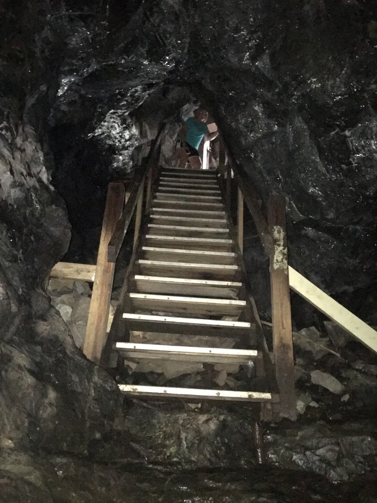
What I expected to walk into was a hollowed out cavern maybe the size of a small room, but what greeted us was an actual mine shaft, and quite a long one at that. We started our journey by descending this set of stairs someone so helpfully installed.

The cave wound back and forth throughout its entire length, never actually going in a straight line, which legend says was due to the spirit constantly "correcting" Hiram's direction. I estimated it's length to be between 100-150 feet, mighty impressive for 2 men to dig without using any machinery.

Nearing the end we felt the tunnel's ceiling getting steadily lower, and I could almost sense Hiram's, or at that point probably Edwin's, desperation to hurry up and dig farther and quicker as time ran short. The tunnel ended in an equally desperate manner, for the first time splitting into two directions and each continuing only a handful of feet at a crawlspaces height - a last ditch change of direction the son didn't quite have time to make.

We left that day thinking pretty much the same thing we did as when we started, poor old crazy Hiram Marble. We pitied him for wasting his life like he did. But later on we learned something about the man that got me wondering. While he was digging he would charge locals for tours of his tunnel, and additionally he sold bonds for a stake in the treasure once he found it. This subsidized his quest to continue doing what he loved, digging for riches, a desire he passed onto his son so strongly that his final wish was to be buried in the ground right outside the cave.

I'm typing these words on a beautiful summer day while stuck inside an office, finishing my lunch break so I can get back to earning my living shuffling papers around a desk. Hiram, on the other hand, earned his living by going on a life-long hunt for pirate's treasure.

Now I'm wondering if I've had it backwards all along. Perhaps it's Hiram who would have felt pity for me.

Wednesday, August 24, 2016

The Forgotten Village of Punkintown


Nestled deep within the woods of Eliot Maine once lived a community of 30-40 people, existing self-sufficiently and separate from the surrounding cities of Eliot and South Berwick. This was known as Punkintown Village. At its height in the 1800's it included anywhere from 7 to 10 families, at least one quarry where they cut stone for their house foundations, and their own grist mill for processing grain. This village survived into the early 1900's until a series of fires and illnesses led to its demise. The woods overtook what remained of the village, and today not a single signpost or marker stands that would point you to where it once stood.

Internet research hasn't been much more productive, with the most entertaining piece of information being the legend of cross-eyed Emma Jane, one of the last inhabitants who would walk into neighboring South Berwick to steal food from gardens and try to sell it back to the townsfolk.

So off we went one Saturday afternoon to try and find the village for ourselves. Our hike began on a dirt road off Route 236, where a trail would supposedly lead us to a pair of lakes the village once sat between. Sure enough, an unmarked trail continued uphill at the end of this dirt road. There were several side paths along the way, but we stuck to the main trail as we believed this was the original horse & buggy "road" that led to Punkintown Village.

Perhaps half a mile into our walk we found this memorial stone, and although nothing about it indicated Punkintown we at least felt we were on the path to somewhere.

Next we came across 3 of these stone pillars, which we thought might be markers of some sort. But although we scoured the area pretty thoroughly we found nothing else of interest nearby.

After a mile of walking what finally suggested to us we had reached the village was this cellar hole. It was set back from the main path and you had to be looking to spot it amidst all the growth, but it was unmistakable once you did.

We reached the end of the main trail without any further discoveries, but many side paths still needed to be explored. The bugs were attacking pretty fiercely though, so we decided that Tina and Logan would return to the car while Barry and I each picked a trail to walk 5 minutes down. It was a last ditch effort to find anything else.

I was perhaps 60 seconds down my trail when I struck gold, coming across the remains of this old cemetery.

It was the Plaisted family cemetery, which I'd remembered reading to be one of the families that inhabited Punkintown Village. It was run down but wonderful, standing alone in the middle of the woods as it was. Like many family cemeteries this one has a large memorial in the center listing each family member,

And many smaller stones with brief descriptions of who was buried underneath, such as this one simply labeled "mother". I can only hope my kids give me something equally as loving when I die.

Finding this cemetery made the entire afternoon worthwhile, and has encouraged us to make subsequent trips back to explore more of the side trails. In three follow up visits we have found another house foundation, a quarry, this fully standing structure,

and this partially standing one.

And although information has been scarce, I did find a reference online that spoke about the remnants of the village, and of its cemeteries. Plural.

Which means there's still more treasure to be found in the woods of Punkintown.