Saturday, February 8, 2020

The Abandoned Movie Set of Patriot's Day


In 2013, terrorist brothers Dzhokhar and Tamerlan Tsarnaev detonated homemade bombs near the finish line of the Boston Marathon, killing three people and injuring hundreds more. In 2016, the movie Patriot's Day starring Mark Wahlberg and Kevin Bacon was released, recounting this disgusting attack. Much of the filming took place at a former naval base in South Weymouth Massachusetts, where the neighborhood and downtown sets that were created for this movie remain standing today.


The South Weymouth Naval Air Station opened in 1942, and during WWII it served as home base to blimps that would patrol the coast of New England for German submarines. Following the war it was downgraded to a parking lot for decommissioned aircraft, but in the 1950s the base was retrofitted with three runways and given new life as a training center for reservists. Blimps went away, jets came in, and operations continued until 1996 when, after a farewell airshow to 100,000 spectators, the base was closed. Much of it has been razed since then, but two of the towers still stand out in the woods.


The set is visible from the road that borders the base, aptly named Patriot Pkwy. From there it's just a five minute walk to the fake neighborhood. This area is open to the public, so you're liable to come across plenty of joggers, dog-walkers, and otherwise friendly people out enjoying their day. Fencing was put up to keep the movie set off-limits, but both times I've been there the gates have been wide open, allowing us to stroll right in.


Depending on which angle the house was filmed at, it was built either to be just a facade or to have some sides and depth. This one - which some local artist mistook for a canvas - would have been used for only a straight shot.


While a house like this was built for a corner shot, and does a pretty good job convincing you someone could actually live there.


Come around the backside and you'll see it's just a front and one side, however.


Almost every house has at least two floors, accessible by either ladder or stairs, so that someone could appear in an upstairs window. Such as my daughter and I.
Front
Back

From a distance things look pretty well built, but upon closer inspection the tricks of keeping within budget are evident. What looks like a brick stairway is just wooden construction with a fake brick layering.


Details large and small went into making this a believable set. Power lines run the length of the street, then abruptly end once out of camera shot.


The second part of the set stands about a thousand feet away, and consists of several business fronts for the downtown scenes. As with the neighborhood, both vandals and Mother Nature have not been kind, although one of the two doesn't know any better.


Green screens at the top of each building allowed them to be given different business names and used for more than one scene.


There's a part in the movie where Mark Wahlberg walks into a bar amidst all the chaos, and before leaving grabs a bottle of liquor and takes a swig. My wife was hoping to re-enact that scene, but unfortunately she forgot the whiskey.


Another thing about this bar, they proudly accept both Vista and BankMaster credit cards.


It was less than six months between the first and second time I explored here, and in that period the condition of the set has drastically deteriorated. There's a reason they put fences around places like this, but those chain walls have failed to keep out the handful of troublemakers who've wreaked havoc here. At this rate, a time will come when this becomes more of an eyesore and less of a novelty, and when that happens the town will be forced to take it down. I worry that day will happen soon - so visit the abandoned movie set now, while you still have the chance.

Friday, January 24, 2020

Slayton Tower, Melrose MA


We plan most of our trips out in advance, but sometimes it's fun just to take off blindly for a place you know very little about. This was our visit to the Slayton Tower, where we made the three hour round trip based on not much more than seeing a picture of it online, and thinking it looked pretty cool. We did know it was located on a golf course, but whether it would be locked from entering, or whether the property itself would be off limits to the public, we had no idea.


Slayton Tower is located at the Mt. Hood Memorial Golf Course in Melrose, Massachusetts, but the first thing we learned is that this is actually the Mt. Hood Memorial Park and Golf Course, and that a public trail system surrounds the course. We parked just north of First Pond, where a kiosk told us how to skirt around the greens to reach the tower. Since this was December and no golf was being played - plus the fact we somehow took a wrong turn and ran out of trail - we cheated across the grass and after about fifteen minutes found ourselves climbing the high point of the park, where the tower came into sight.


But before climbing up there were a few things we wanted to check out first. In a nearby sitting area is a memorial plaque and bench honoring Major Doak A. Weston USAAF. In 1945, the B-25 bomber Weston was piloting began breaking up in mid-air. Heroically, Weston was able to keep the plane aloft long enough for his entire crew to escape by parachute, then he sacrificed his own life by crashing the plane upon this very spot, purposely away from a nearby school and houses.


As evidence that not all humans have a soul, Weston's memorial was defaced with spraypaint several years ago. Happily, it has been perfectly restored.


We also found what we believe are remnants from the days this land was privately owned - this pair of fireplaces sitting in the trees about fifty feet from each other.


Then it was on to the tower. The front gate was open, although a padlock indicated it must be locked at certain times. Round and round, we climbed our way to the top.


During WWII Slayton was used as a lookout tower for German U-boats in the Boston Harbor. Today, if your camera has a decent zoom, you can get a pretty good picture of the city's skyline.


This is a tempting time of year to stay sprawled out on the couch with a Netflix lineup and thick blanket, but when you have such cool places to explore as the Slayton Tower, it's a little easier to get outside and brave the cold during these winter months here in New England.
Photo Courtesy of a Nice Young Lady With Her Two Boys


Links:
Mt. Hood Park Website

Saturday, January 11, 2020

The Raymond Oven Cave, Raymond NH


In the north part of the town, about 100 rods from the principal road leading to Deerfield, near the summit of a hill about 100 feet high, is a natural excavation in a ledge, called the Oven, from the appearance of its mouth. It is a regular arch about five feet high and of the same width, extending into the hill about fifteen feet, and terminating in a number of fissures.


This 170 year old description of a cave hidden within a cliffside in Raymond, NH was more recently popularized in Clay Perry's 1946 book, Underground Treasures of New England". But when I first began my search for it, not a single clue to its location existed online. In fact, the only place that offered any information on it whatsoever was the letters section of the 1998 Northeastern Caver, Vol 29 No 3, in which the author had been told the cave was thought to be lost to construction. This was only a rumor, but with nothing else to go on I back-burner any further thinking about it. Then I was sent a picture by a talented fellow explorer named Chris, showing me that the cave actually did exist, and I was challenged to see if I could find it.


My first attempt started by identifying the principal road in the Gazatteer's description. From Raymond to Deerfield the obvious choice was Route 107, and I hoped this had been the case in 1849 as well. Next, Google then told that 100 rods equaled a third of a mile, so I took a drive looking for any cliffs within sight of the road, and start by exploring those. I spent an enjoyable afternoon in the woods that day, but the only interesting thing I came across was this abandoned motorcycle frame.


After looking again at Chris' picture, it seemed as if the cave had been formed by a waters flow. The Lamprey River runs parallel to Route 107, so for my next attempt I focused on undeveloped areas along the water's edge. A couple of weekend searches turned up several cool finds, but nothing that involved me crawling underground.


I wouldn't call this log cabin elaborate, but somebody put a good deal of effort into building it, even furnishing the inside with some rudimentary decorations.


My wife had joined me on this search, and the look on her face at this moment is one of both humor and disbelief. She had leaned over the well to have a peek inside, when her sunglasses dropped off her head and fell in. The good news was that it wasn't a real well - the glasses were just sitting there on the ground - but the bad news was that "man-eating spiders" prevented her from reaching inside to get them. Always the hero, I brushed aside a couple of daddy long-legs and retrieved the glasses for her.


By now we'd exhausted this section of town, so the next search was focused around a rocky ledge I'd pinpointed using Google Earth - north of 27 and west of 107. I parked where a trail followed power lines toward this ledge, then spent yet another afternoon scouring the woods. Again I came up empty, but this time I was so convinced I had the right area that I returned a week later with friends to do it again. We still didn't find it, but my camera got a good workout with all the other treasures we did come across.


Deeper in we found a few structures that I assume are used by hunters.


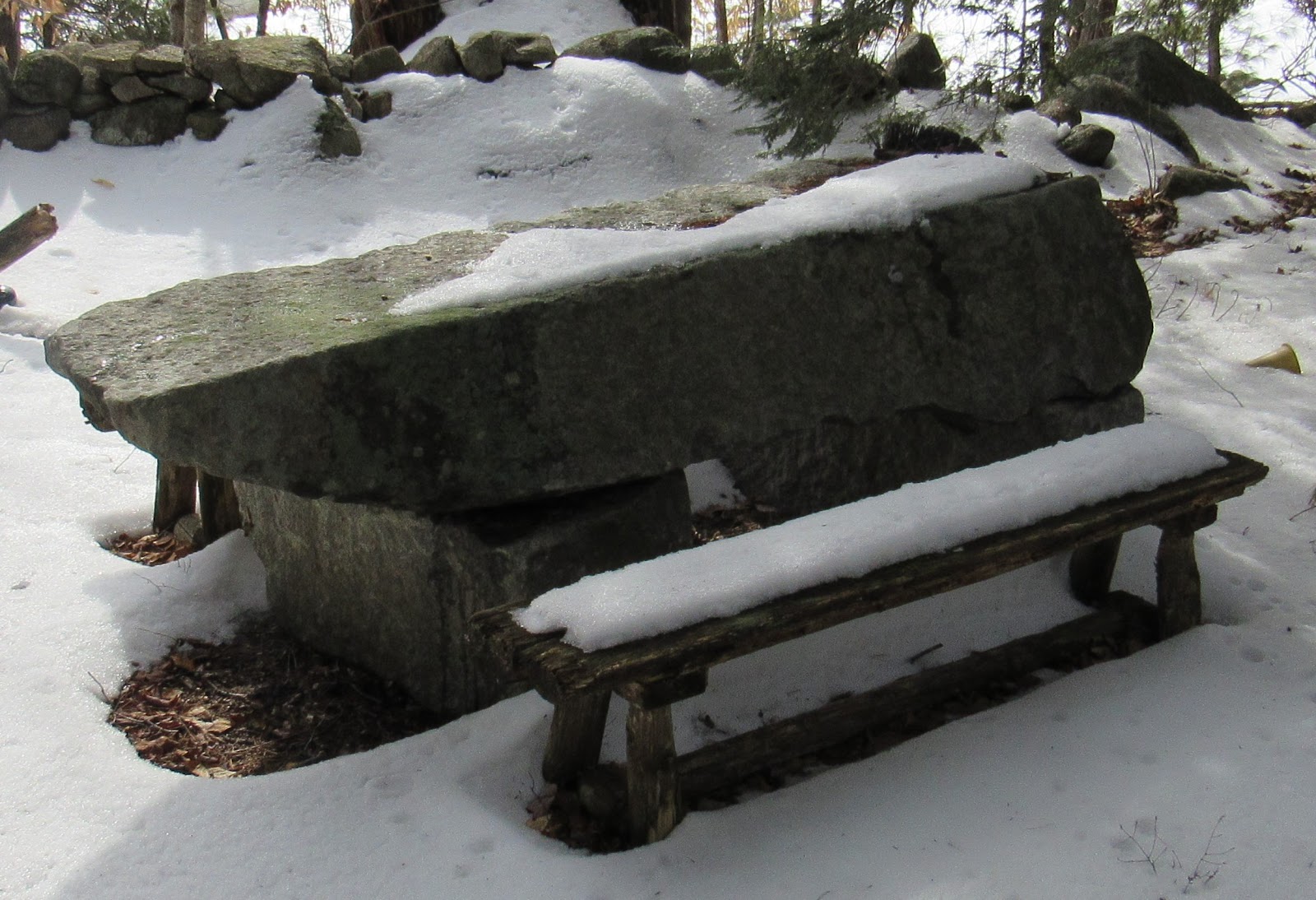
As we wandered the remains of a frisbee golf course, there was a very impressive stone picnic table.


But by the end of the day I was forced to admit that, although these woods held an abundance of cool things, this wasn't the right location for the cave, either. Back to Google Earth I went, and looking to the east this time I found a rocky location that was exactly a third of a mile from 107. The following weekend we were back at it, my sixth attempt to locate the Raymond Oven.

This ledge was separated from the road by a large marsh, leaving no direct route to reach it. We parked in a neighborhood on the opposite side, and after a 1.5 mile hike we found our second homemade cabin in the woods of Raymond.


When we reached the ledge our group of 5 split up, and the race was on. For all my frustrations and chasing dead ends in the weeks leading up to this point, my good fortune changed and I was the first to stumble upon the cave.


As with most legends, there was some exaggeration when it came to the Raymond Oven. As you can see by how I'm sitting in the opening, it is probably half that height of the five feet described in the 1849 Gazatteer.


But it did go in a ways, and we each took turns crawling inside and having a look.


It was great day out in nature spending time with friends, and pretty cool to chase down something as historical and yet little-known as this. Our friends from WeRmudfun documented the adventure on video, so click on this link and join us as we find and explore the Raymond Oven, one of the great treasures of New Hampshire, hidden within its woods.


Saturday, December 28, 2019

NH's Abandoned Transportation Museum


I enjoy those things whose creation was driven by love - built with the same mindset whether one person was going to see it or one million - which was the case with the Beaver Brook Transportation Museum in Mont Vernon. The creators of the museum, Eddie and Beth Gilbert, were buyers of opportunity for all things transportation related, and after moving up from Massachusetts they began displaying their one-of-a-kind collection at their farm. Unfortunately they closed their doors nearly ten years ago, but many of the items still remain if you are a determined explorer.


A small stream separates the property from the dirt road that takes you to Beaver Brook, and I found three entrances that cross this stream and access the museum. Two of them - the collapsing bridges below - are no longer in any condition to use, and the third way in was the property's main driveway. Rather than make myself that obvious, I hid my bike in the woods and rock-hopped across the water.


Here came the first indications that this was a transportation related place. Running parallel to the river along the property side is an overgrown trail, and within it are remnants of an old railroad. Not a full size one, but one of those tourist ones you'd see carrying visitors around an amusement park.


I followed the tracks and soon enough found a couple of the engines. The Gilbert's purchased much of their train collection from the Edaville Railroad Museum out of Massachusetts, a similar tourist spot they frequented before moving to New Hampshire.


I wasn't about to pass up the chance to hop on board and take a few pictures of myself in the conductor position.


After playing on the trains I continued up the trail through the rear of the property, and being that this was a transportation museum it was no surprise when I began finding vehicles in the woods. I could have used my dad at this point, because not only am I sure he would have known the year and model of each one of these cars, but he probably could have told me a story or two about smashing one up in his youth.


I'm still not sure what this truck was, but I left a few present on the dashboard for anyone who finds their way out here.


I'm always respectful on these explorations, and because of that I almost skipped taking a peek inside this tarped building. But I stuck my head inside the door and was glad my curiosity got the best of me.


It seemed to be a catch-all of old exhibits. Among the many items was this trolley, looking like the last thing that's still holding up the roof.


At some point the roof will win out and completely crush this thing, but I trusted it wouldn't be at this exact moment. At one time this must have been a very elegant ride.


To give you an idea of the variety of things the Gilbert's collected - and as evidence I wasn't the first explorer here - I found this broken doll propped up in a wheelchair. Why either of them were in here to begin with, I cannot imagine.


In addition to transportation there were many items related to the Gilbert's second love - Christmas. This is the kind of stocking I hope to see under our tree someday, with the name Dave written across it.


After the barn, I finished my exploration at what I consider the greatest attraction of the museum. We talked about how the Gilbert's were opportunity buyers, and when this giant Santa that once stood outside a used car dealership went up for sale, they snatched it. You can see this Santa from the dirt road leading in, so a few months later I drove my wife by here so she could take a picture with it.


I still chuckle over how anyone could combine such unrelated things as Christmas and transportation into a single, and successful, business, but there are no playbooks to follow when you're creating something purely for the enjoyment of creating it.


Links:

Beaver Brook's official page: https://web.archive.org/web/20200809025704/http://www.beaverbrookmuseum.com/

For a video tour of the museum, and where I first learned about this great place, see this video.